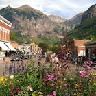
Famous for its fresh mountain air, Colorado is a place to get high – in more ways than one. The mighty spine of the Rocky Mountains cuts through the west of the Centennial State, lifting the landscape up into a rugged tumult of towering mountains, high desert mesa and slot canyons.
Colorado boasts the country’s highest concentration of peaks above 14,000ft – more than 50 in total – but in the east, the landscape flattens out into rolling grasslands which have their own special appeal. Whether you have your heart set on bagging a 'fourteener' or fancy a more gentle stroll in the wilds, there's a trail in Colorado to suit every kind of hiker.
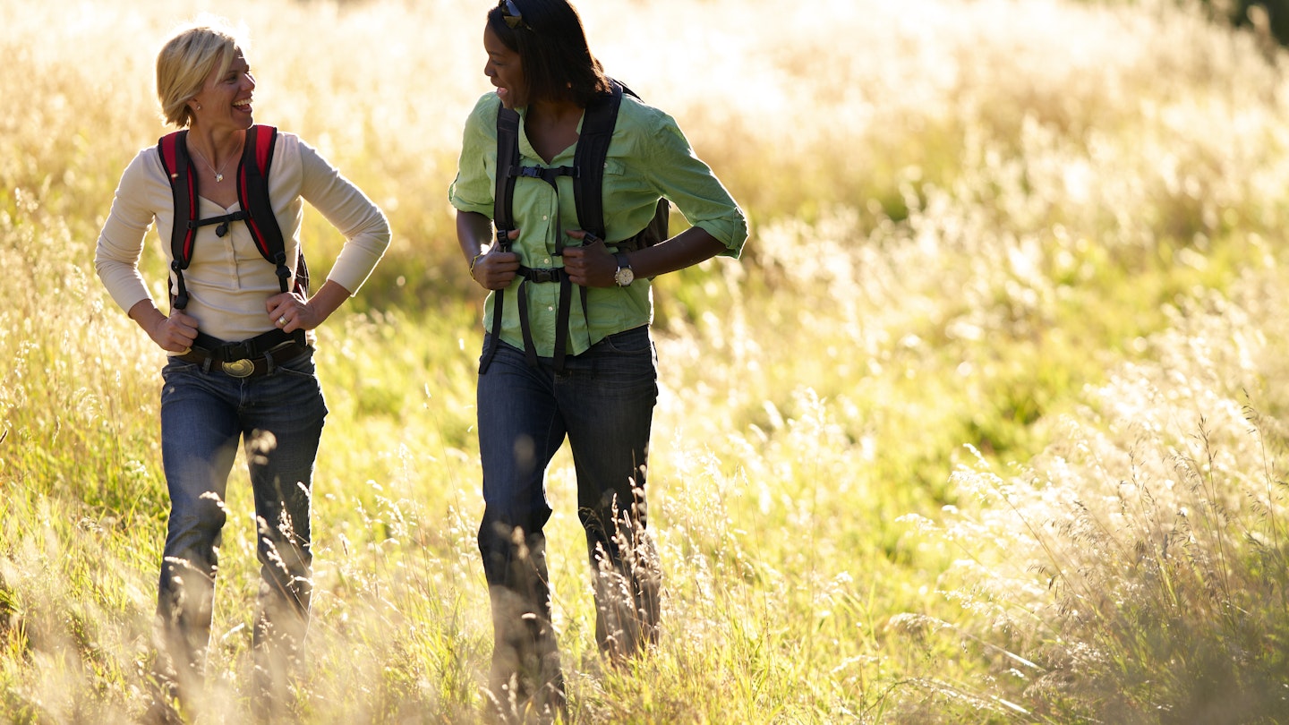
The state's excellent trail system includes routes for all fitness levels, offering year-round access to almost impossibly beautiful landscapes and close encounters with some of the nation's most iconic wildlife. With so many routes to choose from, picking a definitive list of top Colorado hikes is hopelessly subjective. But to get you started, here is our shortlist, with hikes that showcase the state’s impressive variety of landscapes.
1. Longs Peak
Best hard hike
14.5 miles round trip, 10 to 15 hours, difficult
Driving time from Denver: 1¾ hours
Topping out at 14,259ft, Longs Peak towers over magnificent Rocky Mountain National Park, rising high above the Denver skyline. With soaring cliff faces, steep boulder fields and an uber-challenging final ascent, this hike is hugely popular – about 15,000 people attempt to summit it each year – but don’t let that fool you: this is a serious hike, no matter how you approach it.
Most hikers tackle the summit via the so-called Keyhole Route, which begins at the Longs Peak trailhead, between Allenspark and Estes Park on State Highway 7. The first 6 miles are on a moderate trail to a broad boulder field at 12,760ft, where the trail steepens as you pick up the path of the Keyhole Route, marked with yellow-and-red bull’s-eyes painted on the rock.
Even seasoned hikers will be slowed by the thinning air and the route’s precarious ascent over a series of rocky ledges that resemble a narrow cliff-side stairway with no handrails. From there, hikers scramble up a steep final home stretch to reach the boulder-strewn summit. The view from the top – with snow-kissed granite stretching out to the curved horizon – is dizzyingly beautiful.
To avoid afternoon lightning storms, you must summit before noon, so plan on an early morning start at around 4am. Alternatively, make a two-day summit bid; you can detour south just above the tree line to camp at Chasm Lake, a high-alpine wonder that sits below the jagged rock face known as the Diamond, where rock climbing gods and goddesses test their mettle.
2. Mayflower Gulch
Best Easy Hike
5.2 miles round trip, 2-3 hours, easy
Driving time from Denver: 1½ hours
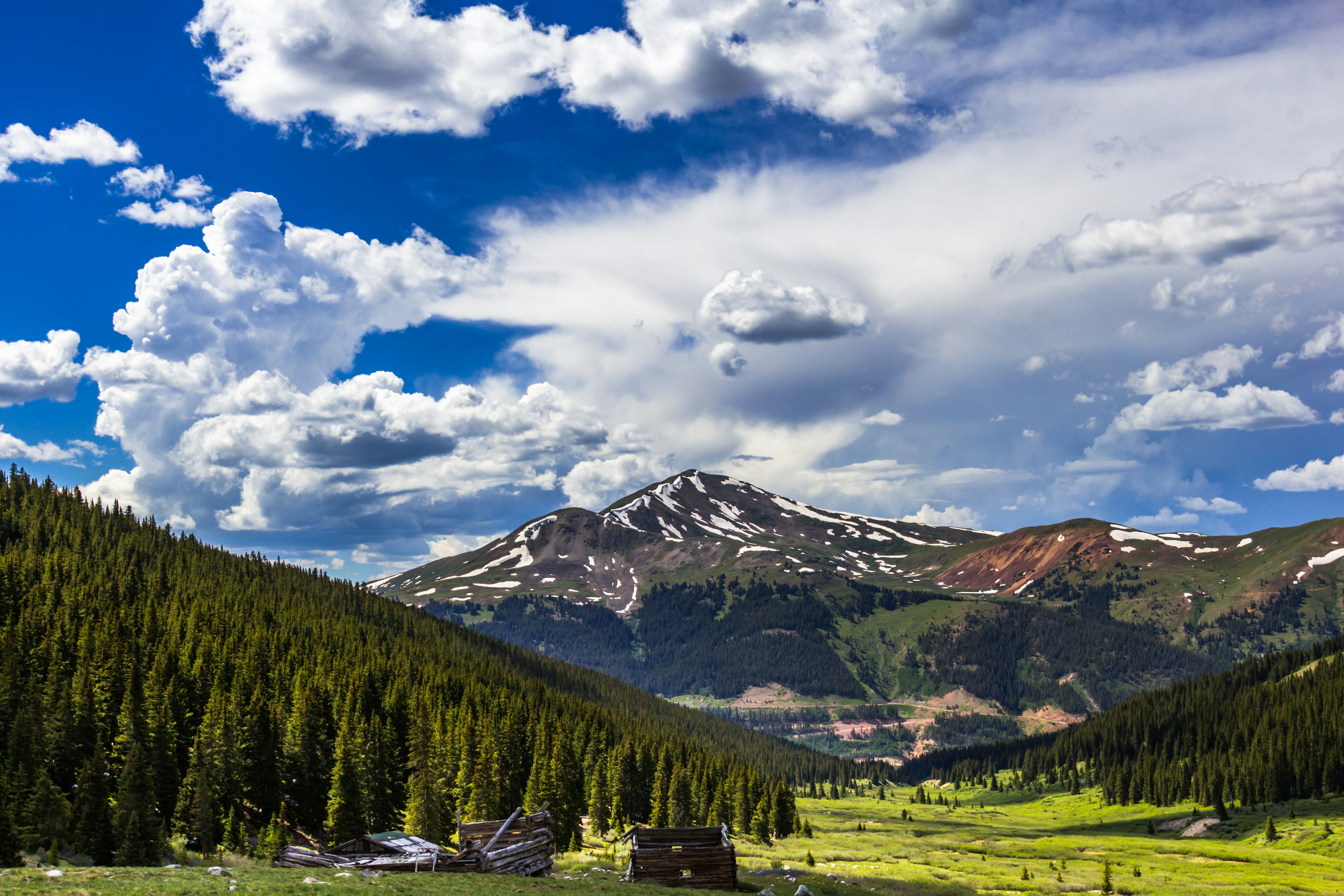
Located in the White River National Forest near Frisco, the Mayflower Gulch trail takes hikers back in time. Climbing gradually to 12,018ft, this out and back trail traces an old mining road deep in the forest, following Mayflower Creek and snaking uphill past crumbling log cabins, rusty mining equipment and an abandoned ore chute – the remains of a failed gold mining town.
The trail ends in a scenic basin that erupts into a riot of wildflowers in summer, and is perfect for snow-shoeing in the winter, with 180-degree views of the sawtooth peaks of Fletcher Mountain. Take time to poke around the ghost town ruins, and consider extending the hike to nearby Gold Hill, a tundra ridge with grand views of the basin below and the pocketed slopes above.
3. West Maroon Trail
Best Wildflowers Hike
10.2 miles one way, 6 to 8 hours, difficult
Driving time from Denver: 5 hours
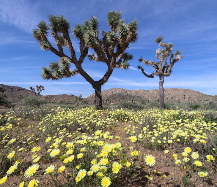
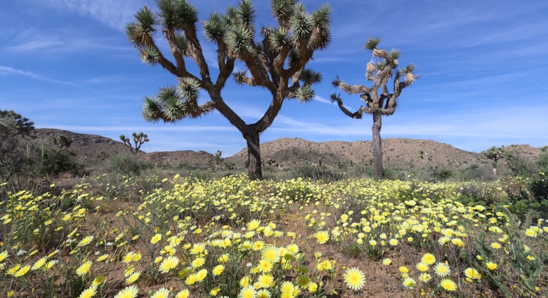
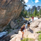
A spectacular carpet of summer wildflowers is the trademark landscape on this dreamy hike between Crested Butte and Aspen, usually tackled during the warmer summer months. Leaving Crested Butte, the opening few miles climb steadily through a mountain valley of flowers, with 2,350ft of elevation gain. Look out for Colorado columbine, Indian paintbrush, lupine, larkspur, Parry’s primrose and more, and look up occasionally to admire the epic vistas of snowcapped peaks and lush forests beyond. The trail steepens near the West Maroon Pass (12,480ft), becoming narrow and rocky as you approach Aspen.
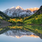
The final push skirts past Crater Lake – dip your toes in its cool waters for a much-deserved rest stop – and climbs through an aspen forest to end at Maroon Lake. This is the most photographed lake in Colorado, thanks to the dramatic backdrop of the Maroon Bells peaks. From the top, you can ride a shuttle back to Crested Butte (4.5 to 5.5 hours) or stay overnight at one of the nearby campgrounds (reservations only) before heading back over the pass on foot.
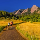
4. The Flatirons (First and Second Flatirons Trail)
Best hike near Denver
2.6 miles round trip, 2 hours, moderate
Driving time from Denver: 40 minutes
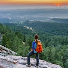
The towering slabs of angled rock known as the Flatirons emerge like the scales of a buried dragon to the south of laid-back Boulder. Several moderate but rewarding trails around the Flatirons can be easily reached from Boulder or Denver, just 30 miles southeast.
The most accessible route here offers instant rewards. An out-and-back trail crosses varying landscapes – floral meadows, patches of forest and a short talus slope – before climbing to a notch between First Flatiron and Second Flatiron, with sweeping views over Boulder and the terracotta-roofed campus of the University of Colorado below.
Switchbacks lead on to the end of the trail on the western side of First Flatiron, where rocky shelves provide the perfect place to pause for a breather, have lunch and enjoy sublime Rocky Mountain views. The trailhead starts at the Ranger Cottage in historic Chautauqua Park, accessible by public transport from Boulder.

5. Rattlesnake Arches Trail
Best hike with an unexpected view
6.2 miles round trip, 5 hours, moderate
Driving time from Denver: 4 hours
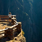
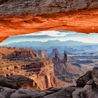
Located in the stunning high desert terrain of McKinnis Canyons National Conservation Area, Rattlesnake Arches Trail is all about sunset red canyons, sandstone pinnacles and nearly three dozen natural arches – the only place you'll find more rock arches is Utah’s Arches National Park.
The trail begins on a sagebrush-covered mesa before getting up close and personal with eight of the largest arches, including Cedar Arch, which measures 76ft across at its widest point. Some daredevils scramble up through its 43ft-tall opening to cut mileage from the return hike. Be sure to take plenty of water on this hike, and keep your eyes peeled for wildlife such as mule deer, desert bighorn sheep and golden eagles.
The trail’s namesake critter, the midget faded rattler, is venomous but rarely seen; it's still worth making noise as you hike and being cautious in the undergrowth. The access road to Rattlesnake Arches is rough, especially the last 2 miles. Visitors with 4x4s or high-clearance vehicles can continue all the way to the main trailhead; most drive as far as they can, and walk once the road becomes impassable.
6. Grays and Torrey’s
Most accessible fourteener hike
8 miles, 6 hours, strenuous
Driving time from Denver: 1¼ hours
Ever wanted to bag a fourteener? How about two in one day? For bragging rights to die for, this heavily trafficked hike starts just an hour outside Denver, climbing up the 14,000ft peaks of Grays Peak and Torrey's Peak in one long, sustained push from the trailhead at the end of Steven’s Gulch Road, near Idaho Springs. Start early in the morning, and head back down to your car before mid-afternoon to avoid afternoon thunderstorms.
The first part of the trail meanders through a high alpine valley, garlanded with gorgeous wildflowers in the early summer. You’ll hit the switchbacks soon enough and then it’s a fairly straightforward climb all the way to the top of Grays Peak. After bagging your first summit, follow the trail as it leads down into a gully, and then climb straight up Torrey’s Peak for a second epic view across the Front Range.
Tips for Hiking in Colorado
- Take time to acclimate to the altitude, especially if you’re coming from sea level – take things slowly for the first few days and pace your climbs.
- Stay hydrated! Carry plenty of water and water-purification equipment. Dehydration will tire you out and can speed the progression of Acute Mountain Sickness (AMS).
- Keep your fuel cells full – bring snacks packed with protein and carbs for the trails.
- Weather conditions can change quickly year-round, so carry layers, rain gear and a hat.
- Afternoon lighting above the timberline is a real danger, especially in the summer. Start hikes early and plan to be away from mountain peaks and high passes by early afternoon. Don’t hesitate to turn back if gray clouds appear – it could save your life.
- Be sure to bring a trail map, compass and flashlight for signaling (don’t depend on your cell phone).
- Make plenty of noise on the trail to avoid unexpected encounters with moose, bears, cougars and rattlesnakes.
You may also like:
Things you need to know to have a great time in Colorado
Colorado on a budget
Top ski resorts in Colorado for beginners to powder hounds