Lush with hardwood forests that turn a rainbow of colors in spring and fall, splashed wildflowers and striped with autumn leaves, Vermont is made for hikers.
Jump in lakes, ponds or waterfalls to cool off and you’re never far from town at hike's end. The locavore movement started in Vermont, and the state has more artisan cheesemakers per capita than anywhere else in the US, as well as a vibrant microbrewery and microdistillery scene. In other words, there’s always a tasty reward waiting when you’re out of the woods.
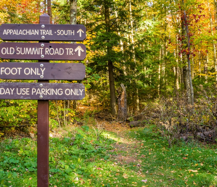
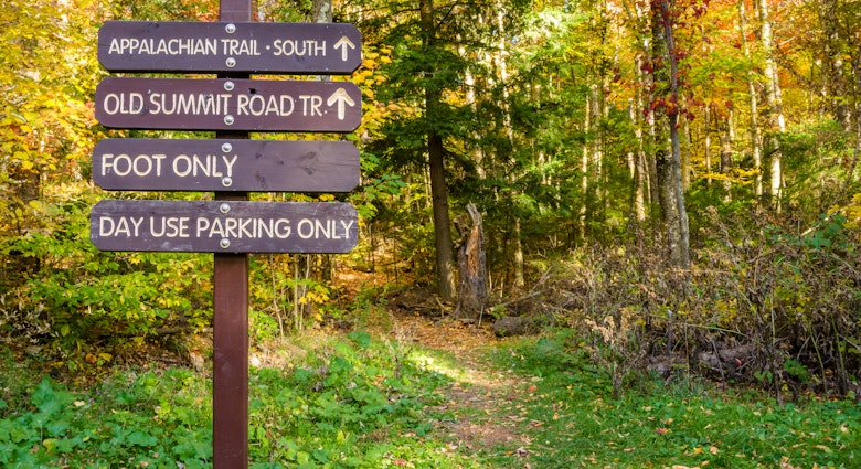
1. The Long Trail
Best thru-hike
272 miles (438km), 5-28 days, easy to challenging
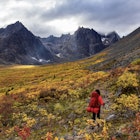
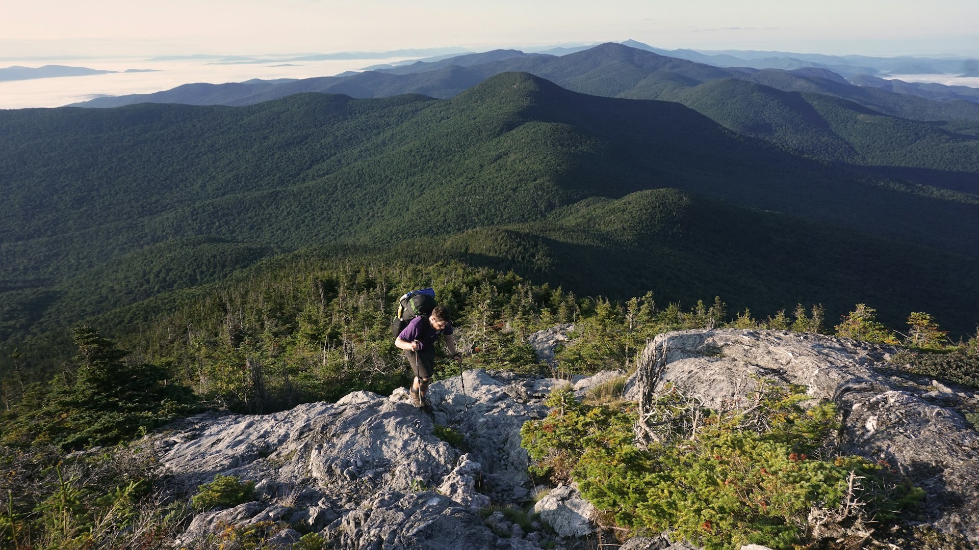
The original thru-hike, the Long Trail is the oldest continuous footpath in the United States and the inspiration for the Appalachian Trail. Meandering along the spine of the Green Mountains, through northern hardwood forests and past alpine tundra, over and sometimes through mountain brooks and streams, the trail extends from Massachusetts to Canada.
Complete the end-to-end hike, and you’ll get bragging rights. But most people do day trips, “section hiking” it over years by hitting the trail for the weekend or even just for an afternoon. More than 166 miles of side trails provide access to the Long Trail and its 70 backcountry campsites.
In southern Vermont, the Long Trail and the Appalachian Trail share the same corridor for 100 miles. The trail gets increasingly rugged as it climbs north toward Mt Mansfield and Jay Peak. Some steep inclines in the north have permanent ladders to help hikers scramble up precipitous rock faces.
Every season on the Long Trail has its wonders and its challenges. Carpets of spring flowers can be accompanied by rainy weather and soggy or snowy summits; warmer summer temps can be crowded, humid and buggy. In fall, the weather is once again unpredictable, but the kaleidoscope of autumn leaves is like nothing else you’ll ever witness. Winter on the trail is beautiful and otherworldly but requires the right clothing and navigation skills.
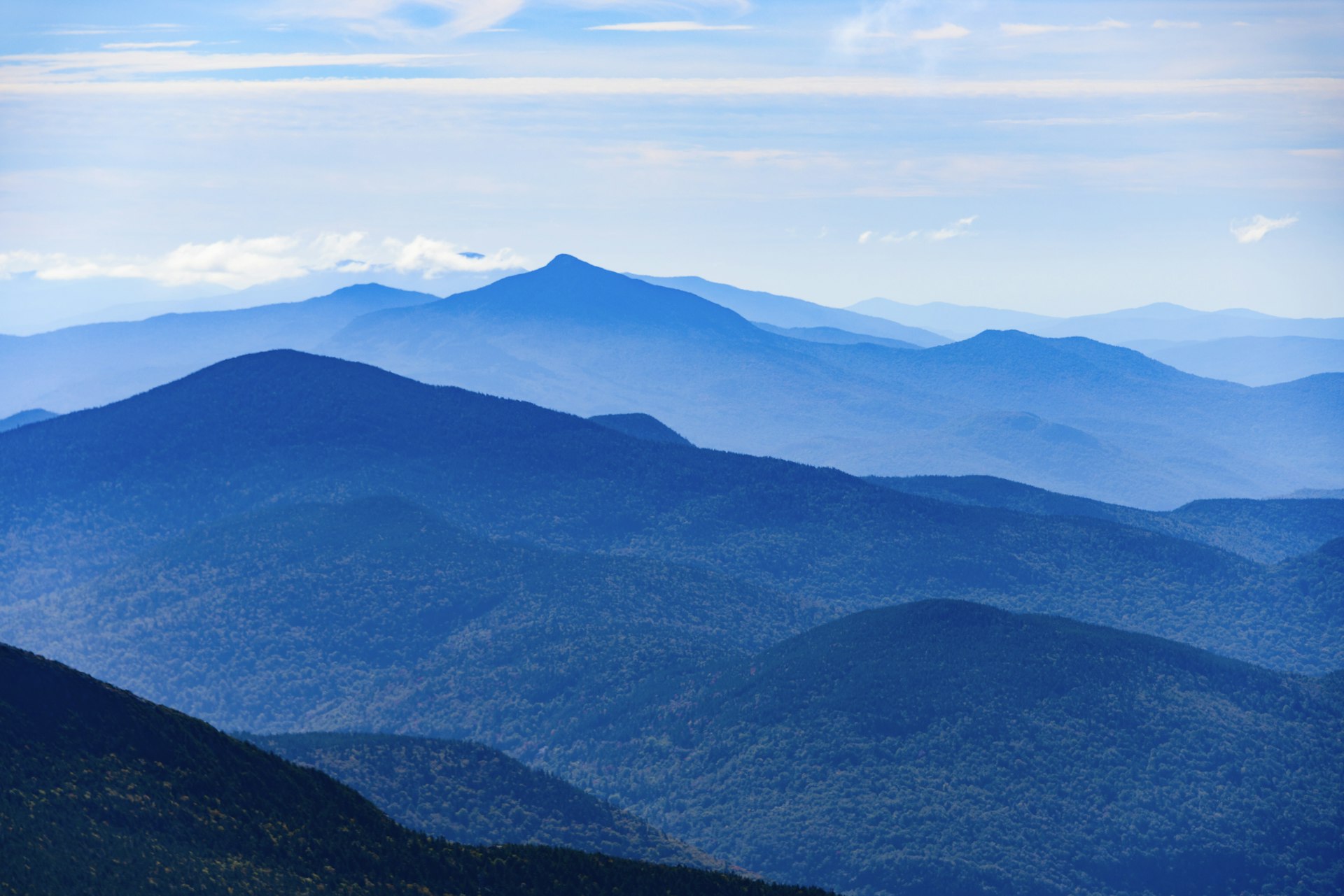
2. Mt Hunger
Best hike for views of Mt Mansfield
4.2 miles (6.8km), 3 hours, challenging
For views of Mt Mansfield, Vermont’s highest peak, from a vantage point in a different mountain range, hike up 3,538ft Mt Hunger. The trailhead is about 45 minutes from Burlington, Vermont’s biggest city, and about 15 minutes from Stowe.
The first mile is mellow, then this out-and-back hike climbs consistently for 2,263ft to the top, and though it’s challenging you’ll be rewarded with panoramic views of the Green Mountain State. Along the way, you’ll step up rocky stairs, traverse under mossy waterfalls, splash in a swimming hole and finally top out on Mt Hunger’s rocky summit, with 360-degree views of New Hampshire’s Presidential Range to the east and the spine of the Green Mountains to the north, south and west.
The last mile is the steepest, but hikers agree that the bird's-eye view of northern New England is well worth the effort.
3. Mt Philo
Best hike for spotting hawks
1.4-1.9 miles (2.25-3km), 1-1.5 hours, moderate
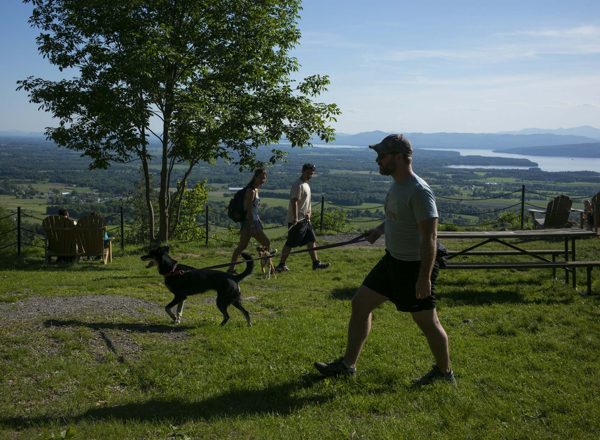
Champlain Valley, home to Lake Champlain, is called Vermont’s breadbasket for its fertile lowland soils and abundant agriculture. The hike up Mt Philo delivers sweeping views of the Valley, as well as Lake Champlain and New York’s million-acre Adirondack Park. Located in Charlotte (pronounced Shar-lot), 968ft Mt Philo stands proud inside Vermont's 232-acre Mt Philo State Park.
In the 1930s, the Civilian Conservation Corps (CCC) planted trees and built roads, trails, a campground, ranger quarters, a picnic area and a summit lodge on top of this natural viewpoint.
Some hikers prefer to follow the paved road to the summit. Others seek out stretches of trail along the way. The paved road and the park’s trails both give walkers and hikers access to the park’s hardwood forests, a glimpse of Mt Philo’s mid-mountain cliff band and, of course, a summit to take in the surroundings.
It’s one of the best locations to spot hawks in Vermont, particularly at the end of September. Mt Philo has the state record for the largest number of migrating raptors seen in a single day – 3,688. Reserve one of the park’s 10 campsites and drive up the access road, or park at the bottom and pay a fee at the entry gate for day use.
4. Grout Pond Trail
Best hike for recreational opportunities
2.7 miles (4.3 km), 1-1.5 hours, easy
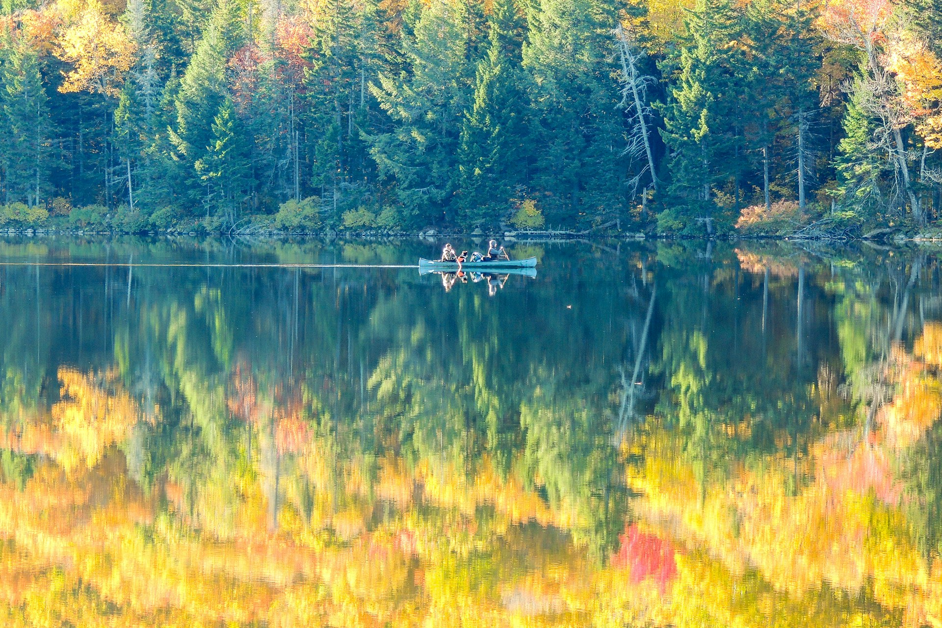
Altitude gain doesn’t define a great hike. Circumnavigate 80-acre Grout Pond, and you only climb 249ft, but you will spot loons, kayakers, wildflowers, mushrooms and mosses while cradled in the heart of the Green Mountains.
Located in the 1,600-acre Grout Pond Recreation Area, Grout Pond is an awesome place to take a dip, cast a line or put in for a paddle. The rec area has 10 miles of multi-use, nonmotorized trails that connect to the Somerset Reservoir trail system, which in winter is home to Vermont’s end-to-end ski trail, the Catamount. The low-lying trails can be wet, so there are boardwalks in sections. There’s also camping, canoeing, kayaking and fishing if you want to mix it up.

5. Mt Mansfield via Sunset Ridge
Best hike for altitude
5.9 miles (9.5km), 3.5 hours, challenging
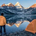
If you come to Vermont to hike, don’t leave until you’ve conquered Mt Mansfield. At 4,395ft, Vermont’s highest peak stands sentry over Stowe to the east and Underhill to the west. It’s one of three rocky mountaintops in Vermont where Ice Age alpine tundra still survives.
Legend holds that it was named for its profile, which looks like the forehead, nose, lips, chin and Adam’s apple of a man in repose; the chin is the peak’s summit. There’s also a legend of a mythological deer/wild boar monster that roams Mansfield’s flanks in one direction only. The Wampahoofus is said to have short legs on one side and long ones on the other from traveling through Mansfield's steep terrain.
There are numerous routes to Mt Mansfield’s summit. Set out from Underhill and hike the open rock ramp called Sunset Ridge, or one of the more challenging trails that parallel it, for the inspiring views. Athletes looking for a challenge should tackle Hell Brook from the Smuggler’s Notch side. The most mellow approach is to drive up the 4.5-mile hairpin-turn Toll Road near the mountain’s “forehead” and traverse to its “chin” (or as far as legs, weather and ambition allow).
6. Mt Abe from Lincoln Gap
Best hike for far-ranging panoramas
5.1 miles (8.2km), 4 hours, challenging
Mt Abraham, dubbed “Mt Abe” by locals, may have been named for former President Abraham Lincoln, but it also may have been named after Revolutionary War hero Benjamin Lincoln, like neighboring Lincoln Peak. Located in Lincoln, Vermont, the peak has also been dubbed Potato Hill and Lincoln Mountain, as well as Mt Abraham Lincoln Mountain.
Whatever you want to call it, the 4,006ft peak is Vermont’s fifth-highest, and the approach to its alpine-tundra-dotted summit ridge is stunning, challenging and breathtakingly beautiful. The most popular trail to the summit follows Vermont’s Long Trail from the summit of Lincoln Gap.
The trail traverses along a rocky path until it hits a lean-to-style shelter with a picnic table and a privy. Then it’s a stout scramble to the summit and one of the best panoramas on the Long Trail. On a clear day, hikers can see New York’s highest peak, Mt Marcy to the west, the slopes of Killington Resort to the south, and 80 miles to the east Mt Washington dominates the skyline of New Hampshire’s Presidential Range.
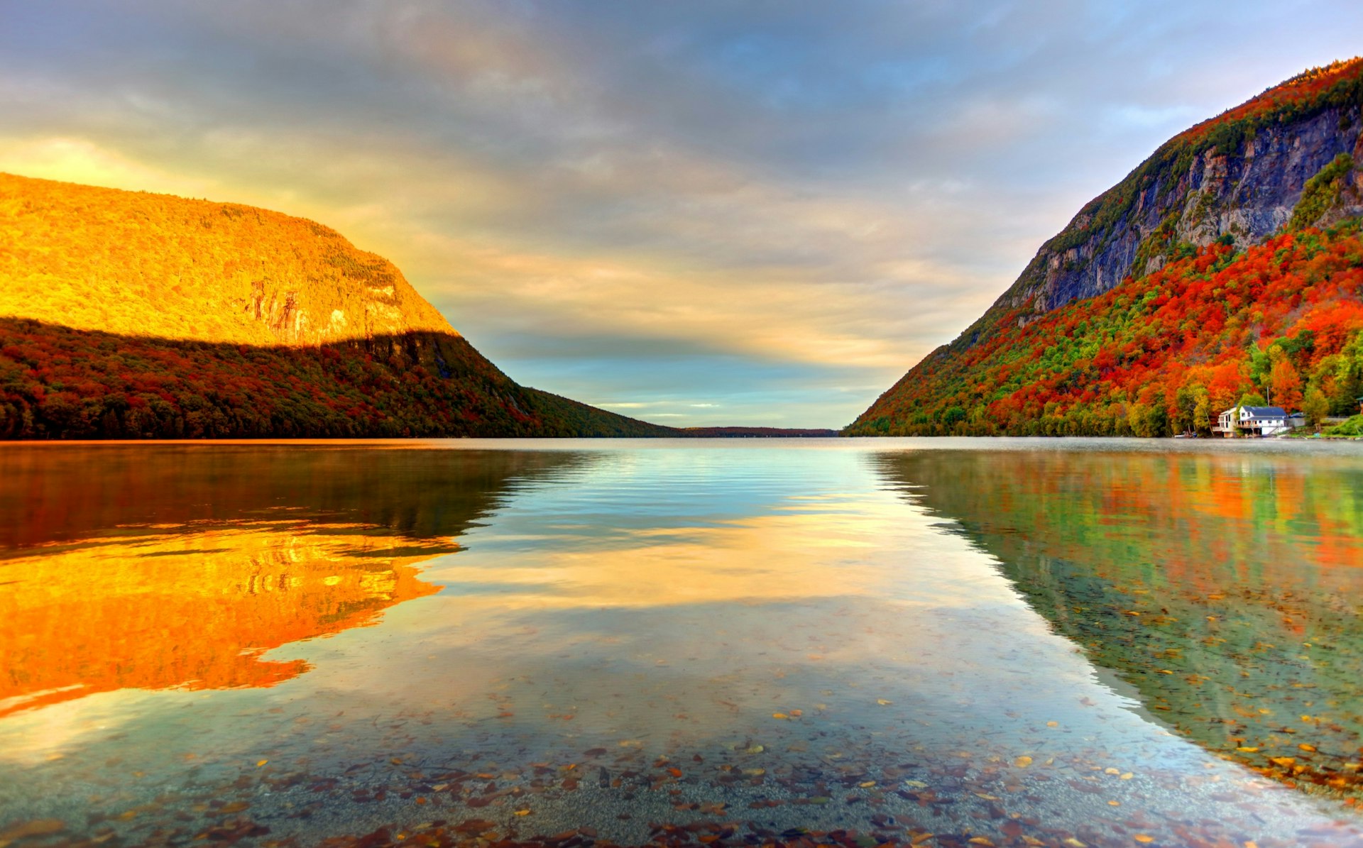
7. South Trail, Mt Pisgah
Best hike for mountain lakes and nesting falcons
4.1 miles (6.6 km), 2.75 hours, moderate
In Vermont’s Northeast Kingdom, Lake Willoughby is one of Vermont’s coldest and deepest bodies of water. Glaciers carved the slash of a lake and pushed up peaks on either side. Mt Pisgah forms the east side of Willoughby Gap, and its sister peak, Mt Hor, towers over the lake’s west side.
Start on the South Trail and you’ll hike for a mile to Pulpit Rock, a peregrine-falcon nesting area and one of the mountain’s best panoramas of Lake Willoughby. Hikers who just want a view sometimes turn around here, while others take the side trail to a rocky perch that feels like it overhangs the lake from 650ft above.
Continue on and it’s a moderate-to-challenging dirt path to the summit ridge and more views of northern Vermont and southern Canada as the ridge veers eastward away from the lake.