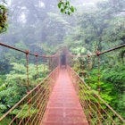
Australia's spectacular biodiversity is enough to wow even the most veteran outdoors-people – sheer cliff lines, rolling desert dunes, wetlands teeming with life, dense forests and mountain ranges all make an appearance in the country's national park system. Believe it or not, Australia has more than 500 national parks, which can make decision making tough. Here are some of our favorite national parks Down Under.
Editor's note: during COVID-19 there are restrictions on travel and opening hours may vary. Check the latest guidance in Australia before planning a trip, and always follow local health advice.
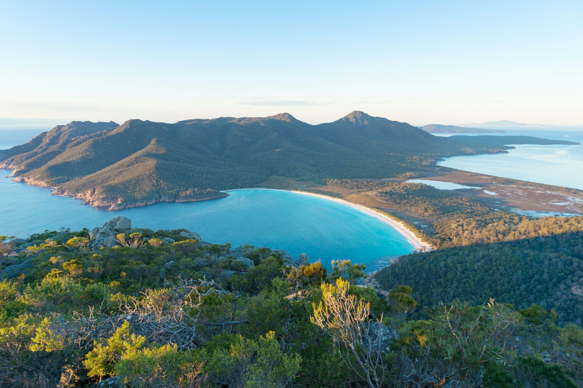
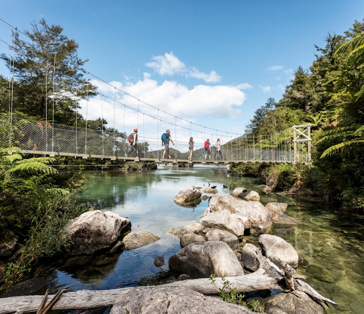
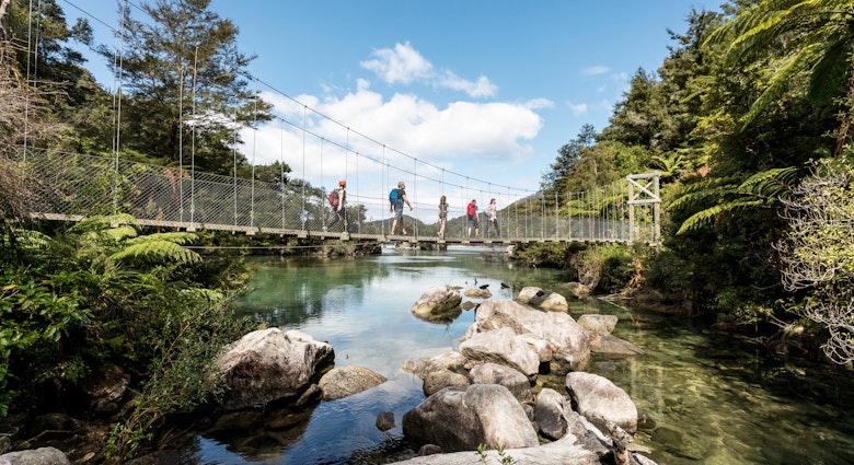
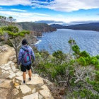
Freycinet National Park, Tasmania
Framed by some of the state's finest beaches and rising into spectacular low mountains, Freycinet incorporates the southern end of Freycinet Peninsula, people-free Schouten Island and the lesser-known Friendly Beaches north of Coles Bay. Thanks to the photogenic assembly of pink granite mountains, azure bays and white-sand beaches, the bushwalking here is brilliant. Longer hikes include the three-day, 18.6-mile (30km) Freycinet Peninsula Circuit, and shorter tracks include the up-and-over saddle climb to Tasmania's most famous beach, Wineglass Bay. Ascend the saddle as far as Wineglass Bay Lookout or continue down the other side to the beach. Alternatively the 1640ft (500m) wheelchair-friendly boardwalk at Cape Tourville affords sweeping coastal panoramas and a less-strenuous glimpse of Wineglass Bay.
The park has a host of wildlife – black cockatoos, yellow wattlebirds, honeyeaters and Bennett's wallabies flap and bounce between the bushes, and you might catch glimpses of white-bellied sea eagles, dolphins or even whales.
Coorong National Park, South Australia
The amazing Coorong National Park is a fecund lagoon landscape curving along the coast for 90 miles (145km) from Lake Alexandrina towards Kingston SE, a convenient outdoor getaway close to Adelaide. A complex series of soaks and salt pans, it's separated from the sea by the chunky dunes of the Younghusband Peninsula. Birders will particularly enjoy their visits, as more than 200 species of waterbirds live here. The Traditional Owners of the land are the Ngarrindjeri people, and the region continues to be very culturally significant.
Activities include canoeing and fishing, and the park also encompasses some nice hiking trails and 4WD routes. Camping here is quiet and peaceful, with great views of the night sky.
Port Campbell National Park, Victoria
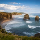
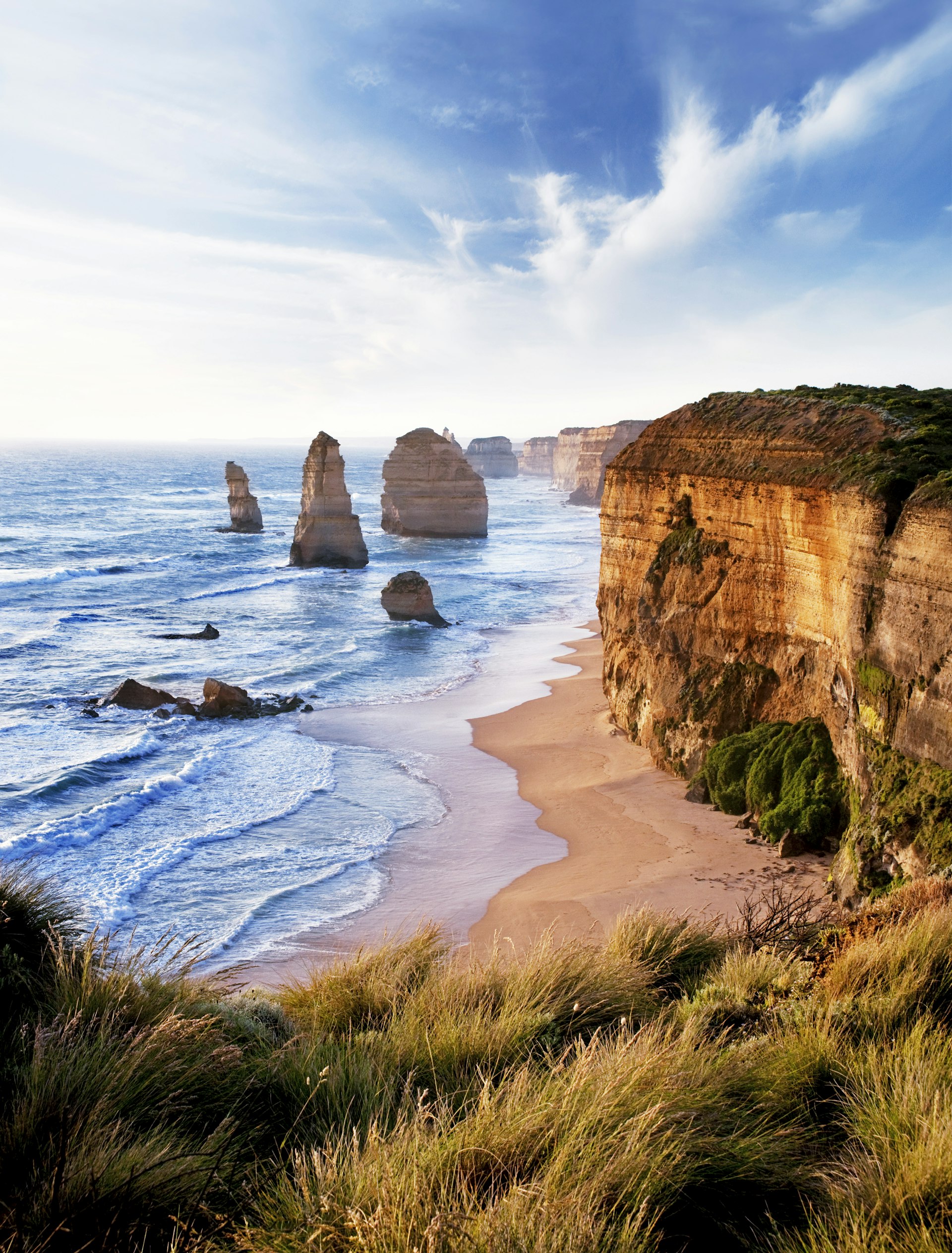
West of the Otways, the Great Ocean Road levels out and enters narrow, flat, scrubby escarpment lands that fall away to sheer, 230ft-high (70m) cliffs along the coast between Princetown and Peterborough, the traditional land of the Kirrae Whurrong. This is Port Campbell National Park, home to the Twelve Apostles, the most famous and most photographed stretch of the Great Ocean Road. However, don't for a moment think that the Twelve Apostles constitute the road's end point. There's a string of iconic rock stacks west of Port Campbell, some arguably more scenic than the Apostles themselves, among them the Bay of Islands and London Bridge.
The viewpoints draw thousands of visitors a year, but don't be in such a hurry to flit from one to the next by car. Take a little time for some of the lovely cliffside walks to learn more about the geological processes at play and the wildlife that call the shrubbery home.
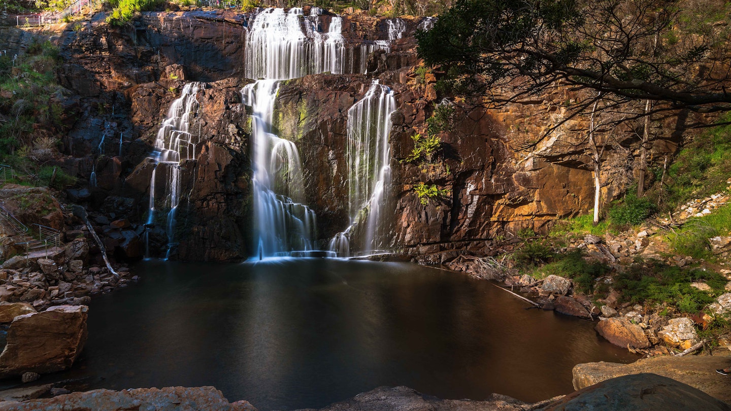
Grampians National Park, Victoria
Rising up from the western Victorian plains, the Grampians are a haven for bushwalkers, rock climbers and nature lovers, and they are one of the Victoria's most significant natural and cultural features. The rich diversity of wildlife and flora, the unique rock formations, the Aboriginal rock art, the spectacular viewpoints and the extensive network of trails and bush campsites are sure to keep all visitors busy. One of the park's most popular sights is spectacular MacKenzie Falls, and other popular places include Boroka Lookout, with excellent views over Halls Gap and Lake Bellfield, and Reed Lookout, with its 1.2-mile (2km) return walk to the iconic Balconies and views over Lake Wartook.
The Jardwadjali people call the mountains Gariwerd – in the local language "gari" means "pointed mountain," while "werd" means "shoulder." The traditional Aboriginal owners – namely the Jardwadjali and Djab Wurrung – have been occupying Gariwerd for more than 20,000 years and this is the most accessible place in Victoria to see Indigenous rock art. The paintings are spread across the Gariwerd region, and you'll need a car to access them; better yet, join a guided tour with the Brambuk Cultural Centre.
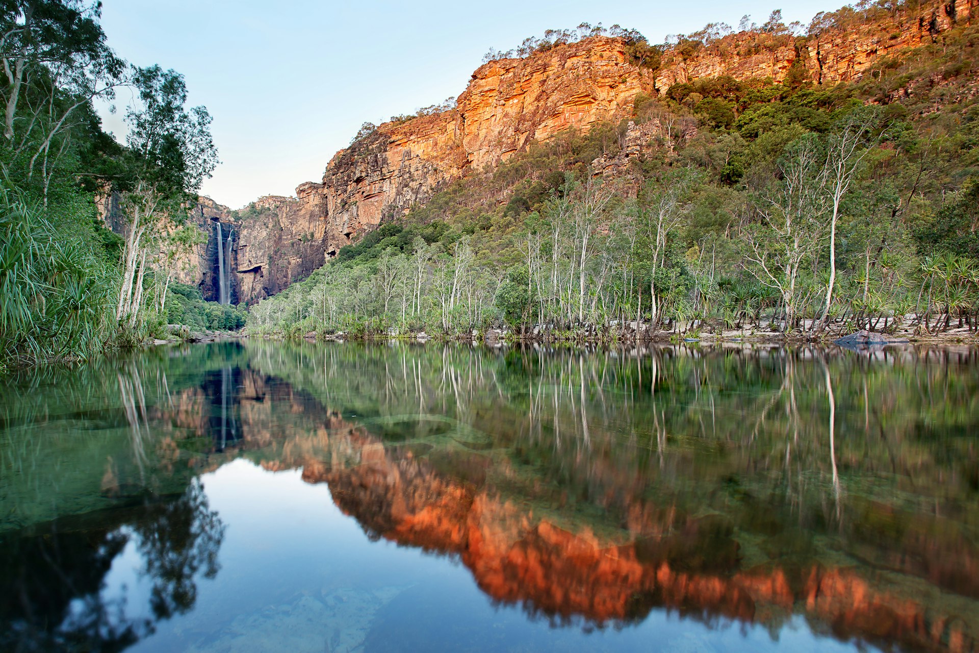
Kakadu National Park, Northern Territory
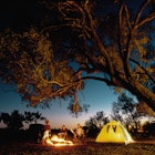
Kakadu is one of the world's great national parks, combining an astonishing array of attractions. Its wetlands and escarpments shelter abundant wildlife and rock art that can date back 20,000 years. This is the traditional land of the Bininj/Mungguy, and opportunities for exploring the park with Indigenous guides are many. There are abundant walking trails, tours, waterholes and 4WD tracks for self-guided exploration, too, and plenty of places to rest your head under the stars.
In just a few days you can cruise on billabongs bursting with wildlife, examine 25,000-year-old rock paintings , swim in pools at the foot of tumbling waterfalls and hike through ancient sandstone escarpment country. Ubirr and Nourlangie are the main rock-art sites, Jim Jim has the best falls, Cahill's Crossing is terrific for crocs, and Yellow Water is great for birds and crocs.
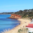
Dhilba Guuranda-Innes National Park, South Australia
Sheer cliffs plunge into indigo waters and rocky offshore islands hide small coves and sandy beaches in this national park at the southern tip of the Yorke Peninsula, land traditionally owned by the Narungga nation. There are some fabulous beach and bush campsites here, plus heritage accommodation in the abandoned gypsum-mining town of Inneston. The surf rolls in at Pondalowie Bay, and bird-watching is a fruitful pastime – ospreys and emus abound, as do the endangered malleefowl and threatened hooded plover. If you happen to visit in winter, you just might be able to spot southern right whales from Cape Spencer or Stenhouse Bay.
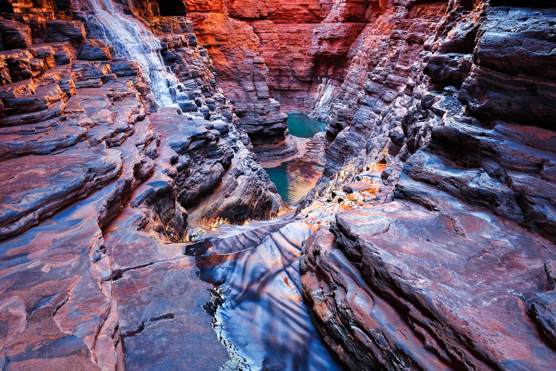
Karijini National Park, Western Australia
The breathtaking gorges, hidden pools and spectacular waterfalls of the 2423-sq-mile (6275-sq-km) Karijini National Park form one of Western Australia's most impressive attractions. Nature-lovers flock to this red slice of the Hamersley Range and its deep, dark chasms (the traditional lands of the Banyjima, Kurrama and Innawonga peoples), home to abundant wildlife and over 800 different plant species. Kangaroos, snappy gums and wildflowers dot the spinifex plains, rock wallabies cling to sheer cliffs and endangered olive pythons lurk in giant figs above quiet pools. The park also contains WA's three highest peaks: Mt Meharry, Punurrunha (Mt Bruce) and Mt Frederick.
Summer temperatures reach extremes in the park (frequently over 104°F / 40°C), so carry plenty of water, and winter nights are cold. At any time of year, choose walks wisely, dress appropriately and never enter a restricted area without a certified guide.
Gheebulum Coonungai (Moreton Island) National Park, Queensland
Moreton Island is the third-largest sand island in the world, and its unspoiled beaches, dunes, bushland and lagoons make it a striking destination to visit. The national park covers over 95% of the island, and this protected natural wonderland delivers snowfields in winter, vivid wildflowers in January, and pristine lagoons, creeks and beaches year round. Among these is the freshwater Blue Lagoon, a popular swimming and kayaking spot, and the challenging but panoramic Mt Tempest, which at 919ft (280m) is the tallest vegetated sand dune in the southern hemisphere. Off the west coast are the rusty, hulking Tangalooma Wrecks, which provide excellent snorkeling and diving.
Moreton Island has a rich cultural history as well. The island lies within an area known as Quandamooka, a region including Moreton Bay and its islands, and the Traditional Owners of the land are the Ngugi people.
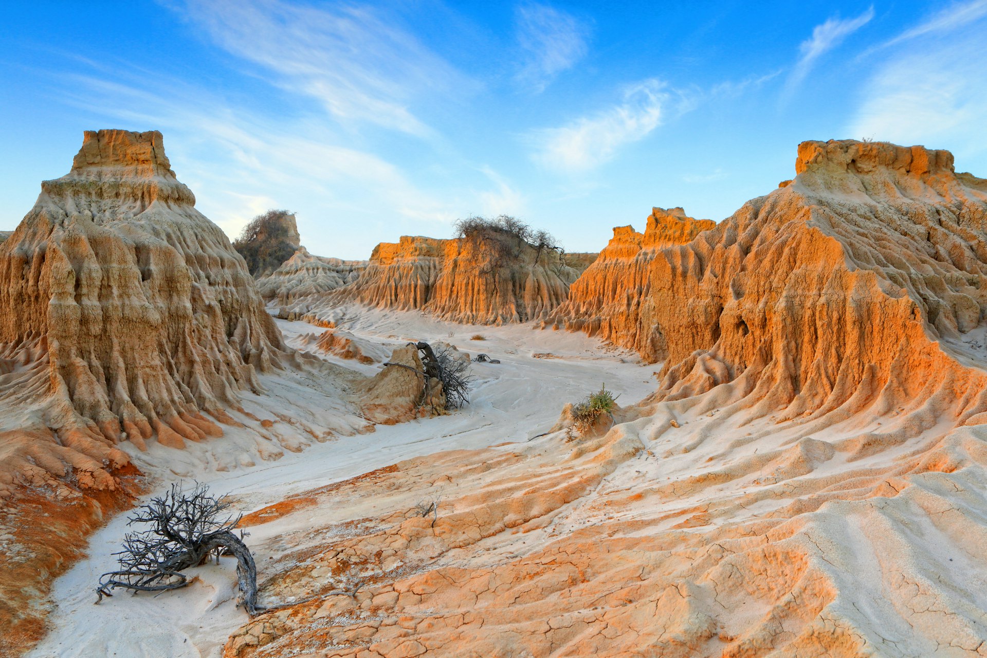
Mungo National Park, New South Wales
Remote and beautiful, Mungo National Park covers 68,790 acres (27,850 hectares) and echoes with over 400 centuries of continuous human habitation. A 20.5-mile (33km) semicircle (lunette) of huge sand dunes, known as the Walls of China, has been created by an unceasing wind that constantly exposes ancient Indigenous artifacts, burial grounds and even fossilized footprints. The park is part of the Willandra Lakes region, which has been designated a World Heritage site thanks to its mind-boggling cultural and geological history.
From the Main Campground there are short walks such as the .75-mile (1.2km) loop Grasslands Nature Stroll and a short path from the carpark to Mungo Lookout. From the visitor center the 1.6-mile (2.5km) Foreshore Walk follows the ancient shoreline of Lake Mungo, or you can walk or cycle the 6.2-mile (10km) Pastoral Heritage Trail, linking the old Mungo Woolshed with the remnants of the Zanci Homestead precinct built in the 1920s.
Girringun National Park, Queensland
Girringun National Park is home to the country's longest single-drop (879ft/268m) waterfalls, which lie within the traditional lands of the Warrgamaygan Aboriginal people. The cascades look their best in the wet season, though they're spectacular at any time. The park encompasses six different areas – Blencoe Falls, Dalrymple Gap track, Mount Fox, Princess Hills, Wairuna and Wallaman – and the dense rainforest, numerous creeks and deep gullies makes for incredible wildlife watching. Keep an eye out for the endangered cassowary, whose prehistoric-looking countenance will have you feeling like you're actually in Jurassic Park.
You might also like:
A guide to camping and cooking in outdoors Australia
Australia's best natural wonders
When is the best time to go to Australia?