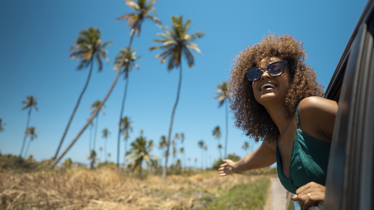
Getting behind the wheel of a car in Brazil opens the door to a world of road trip adventures. Distances may be long and routes may be rough in places, but the sense of achievement that comes from driving the country’s snaking coastal byways, inland highways and high mountain roads will stay with you for a lifetime.
With the opt-in approach to road traffic laws and the fact that 87% of Brazil's rodovías (highways) are unsurfaced, undivided roads, driving in this huge country isn't always easy, but don’t let that put you off. If you stick to daytime driving and avoid bigger cities, road travel in Brazil gets a lot less stressful.
With some careful planning and a philosophical commitment to taking it slow, a road trip through Brazil can be an uplifting adventure through a world of natural wonders. Here's our guide to the best road trips in Brazil.
Rio-Santos Road
Best road trip for beautiful beaches
Santos–Rio de Janeiro; 550km (341 miles)
The coastal road linking Rio de Janeiro and São Paulo is definitely not the quickest way to get between the two cities, but it’s certainly the most interesting.
Wedged between the forest-covered slopes of the Serra do Mar and the Atlantic Ocean, this winding route takes in all the curves of the coastline, passing thousands of beaches and hundreds of islands, some of which are well worth an overnight stop (Ilha Grande and Ilha Bela are standout places to break the trip).
While the journey can be completed in two or three days, it’s worth taking your time. The road was built in the 1970s and it has views of the ocean for much of the way, crossing sparkling rivers and passing peaceful fishing villages as well as more bustling vacation spots.
The Portuguese-founded town of Paraty is an essential overnight stop, as are the pristine beaches north of Ubatuba, such as Praia do Félix and Itamambuca.
Leave time for activities, too. Along the way, you can explore waterfalls, hike in the dense Atlantic Forest and enjoy tastings at distilleries making cachaça (a distilled spirit made from fermented sugarcane juice). Make regular pit stops at beach shacks or upscale restaurants to try caiçara cuisine, the seafood-rich cooking tradition of the coastal communities in Brazil’s southeast.
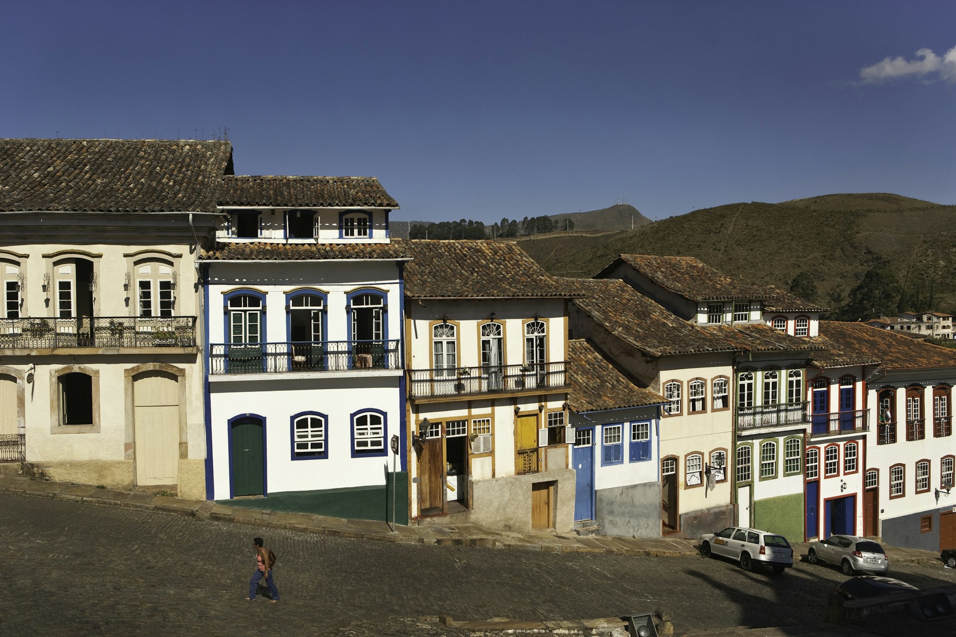
The Royal Road
Best road trip for historical sites
Ouro Preto–Paraty; 710km (441 miles)
The Estrada Real (Royal Road) charts a major slice of Brazil’s colonial history along its 932-mile route. Actually a network of roads rather than a single route, the Estrada Real was built on the labor of thousands of enslaved people from the 17th century onward to connect the mining towns in Brazil’s interior with the ports in Paraty and later Rio de Janeiro, from where gold and diamonds were shipped to Portugal. So, yes, the usual colonial story...
These days, the route stands out for its scenery, culture and architecture, linking many of Brazil's most striking Portuguese-era townships. To help with route-finding, the Instituto Estrada Real can provide maps and a Royal Road “passport” that can be stamped at checkpoints along the way.
The most interesting stretch is the Caminho Velho (Old Route), which links the colonial towns of Ouro Preto, Tiradentes, Mariana and Congonhas, famed for their baroque churches and steep cobbled streets.
The Caminho Velho takes about eight days to drive and mainly follows dirt roads, so a 4x4 is a must. The route starts in Ouro Preto and ends on the coast in Paraty – both are Unesco World Heritage sites, hailed for their history and biodiversity, respectively.
Stop along the way to visit waterfalls, traditional cheesemakers and restaurants serving comida mineira (the region's hearty comfort food – packed with corn, cassava, beans, and pork and slow-cooked on a wood-fired range). Trips can be planned around the route’s many festivals, covering everything from film to photography to food.
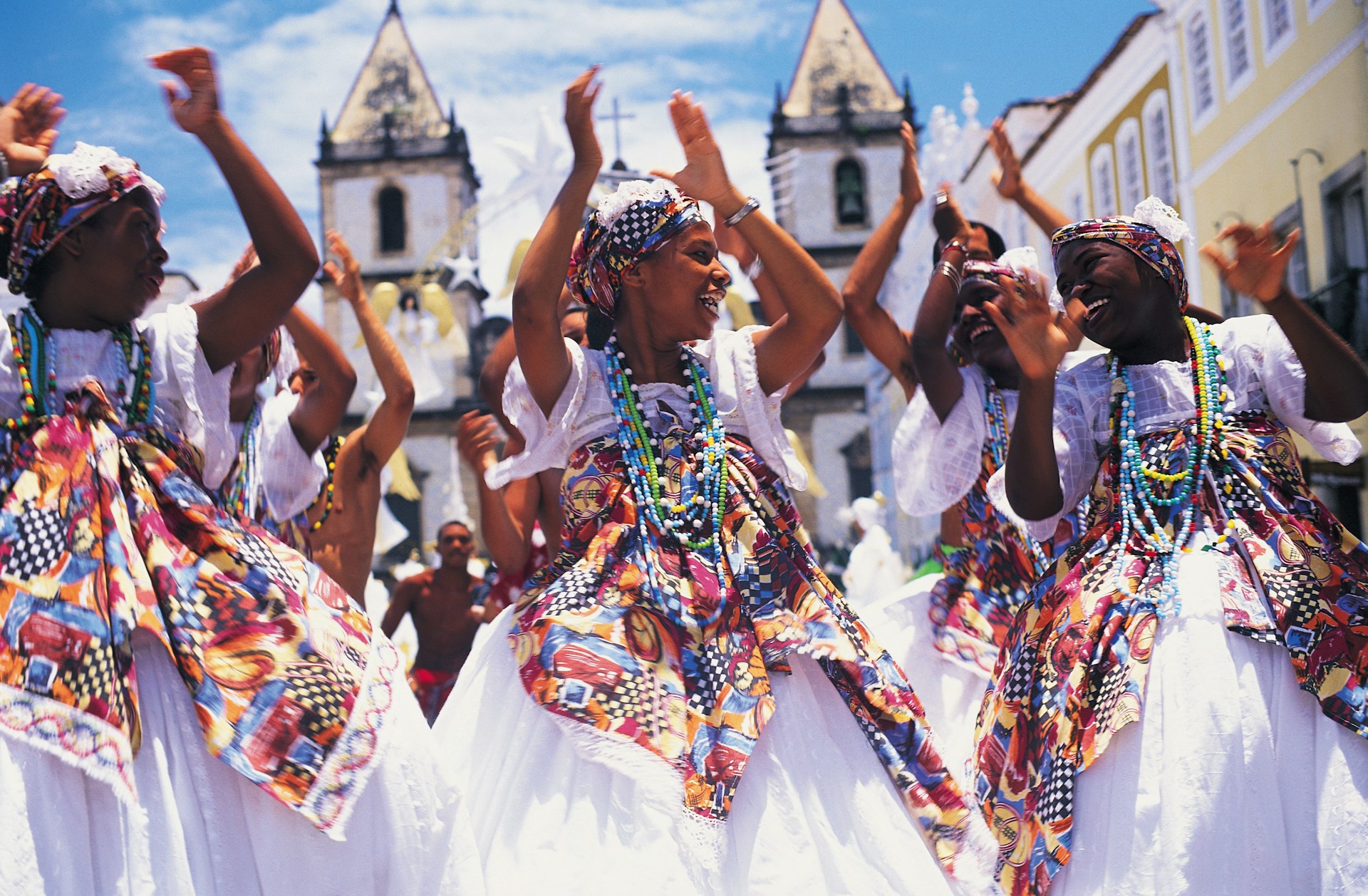
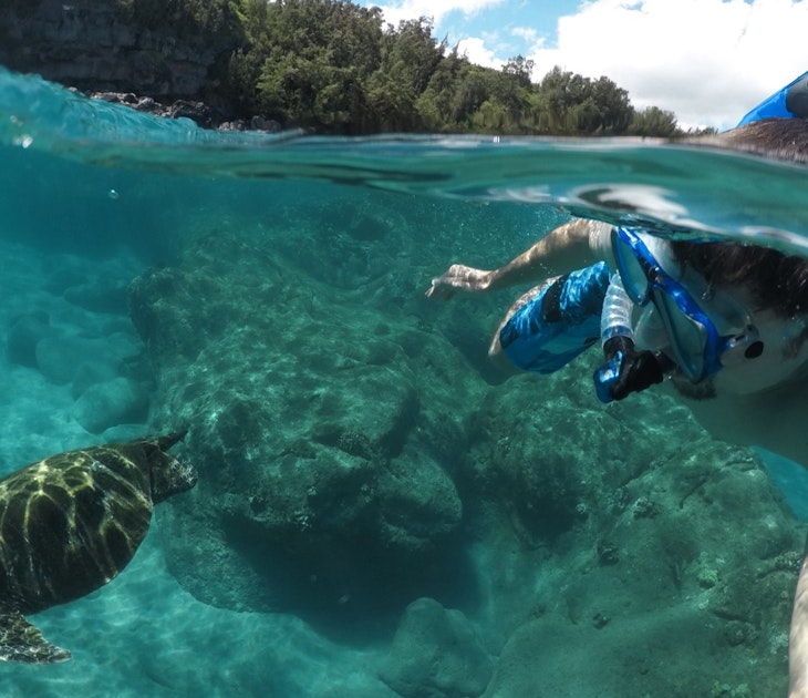
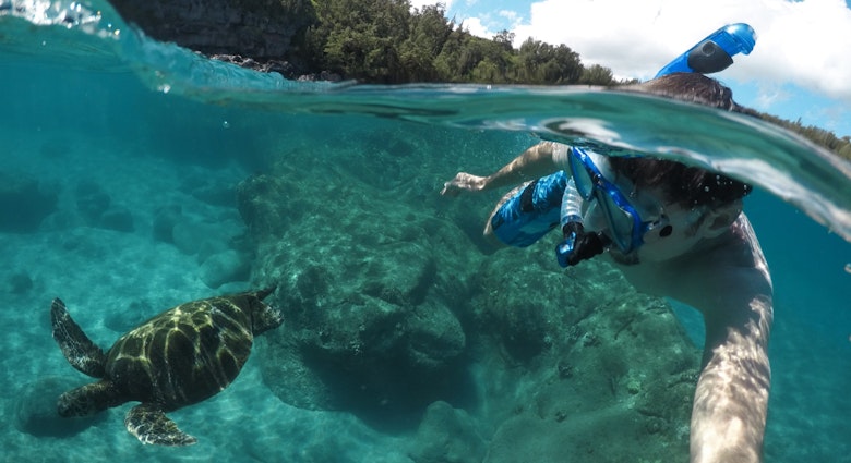
The Northern Bahian coast
Best road trip for sea views
Aracajú–Boipeba; 560km (347 miles)
Bahia is the Brazilian state with the longest coastline – an impressive 930km (579 miles) of chic beach resorts, small fishing villages and everything in between. Coconut Coast, Cacau Coast and the Discovery Coast are some of the evocative monikers applied to specific stretches of this coastline.
In Bahia, no one is in a hurry, and that’s the best approach to take on this road trip, stopping as often as possible for fresh seafood lunches and dips in the sea.
Starting in the Sergipe state capital of Aracajú, it’s an easy drive south to Mangue Seco, a beautiful peninsula on the northern tip of Bahia state and the start of the palm-fringed Coconut Coast. The vacation town of Praia do Forte and the Tamar turtle preservation project are well worth a visit, too, before reaching Salvador, the historic state capital and the heart of Brazil’s Afro-Brazilian culture.
A regular car ferry crosses the Bay of All Saints to Bom Despacho, from where the Dendê Coast heads south, offering more appealing beach stops. To finish, park up in Valença or Graciosa and take a small speedboat over to Boipeba Island, famed for its pristine white sand and turquoise waters.
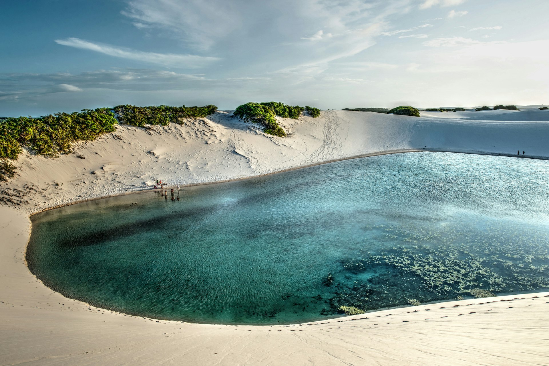
Rota das Emoções
Best road trip for escapism
São Luís do Maranhão–Jericoacoara; 642km (399 miles)
A ride on the wild side might be a more poetic translation of Rota das Emoções – the "Route of Emotions" (happy ones, we hope). The long stretch of road that connects São Luís, the capital of Maranhão, with the seaside vacation town of Jericoacoara takes in the natural wonders of this wind-swept corner of Brazil’s northeastern coast.
The first stop is Lençóis Maranhenses, where crystal clear freshwater lagoons form during the rainy season across a 1550 sq km (598 sq mile) expanse of sand dunes. To take in the majesty of Lençóis Maranhenses National Park, a chartered flight offers the best vantage point, though hiking, quad bikes and jeep tours allow visitors the bonus of a dip in the lagoons.
Next, stop at the Parnaíba River Delta, where dozens of islands are home to mangrove forests and a set of flora and fauna best explored by boat. Flocks of bright red guarás (scarlet ibises) fill the skies as they come in to roost at sunset.
The final stretch is along the Ceará coast – one of the world's top destinations for kitesurfing – ending in Jericoacoara (or “Jeri”) for a few days soaking up the beauty of the neighboring national park, kitesurfing or just relaxing on the beach. The town is surrounded by sand dunes and sea, but it is possible to drive all the way to Jeri by picking up a local guide in Jijoca or Prea and deflating your tires for sand driving to navigate the final stretch.
Otherwise, you can park outside the dunes and take a transfer by 4x4. The small town of Camocim also has parking options and beach buggy rides to Jeri.
Estrada Transpantaneira
Best road trip for wildlife
Poconé–Porto Jofre; 150km (93 miles)
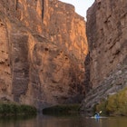
The Pantanal is the world’s largest wetland, covering some 209,790 sq km (81,000 sq miles), mostly in Brazil but also spilling into neighboring Bolivia and Paraguay.
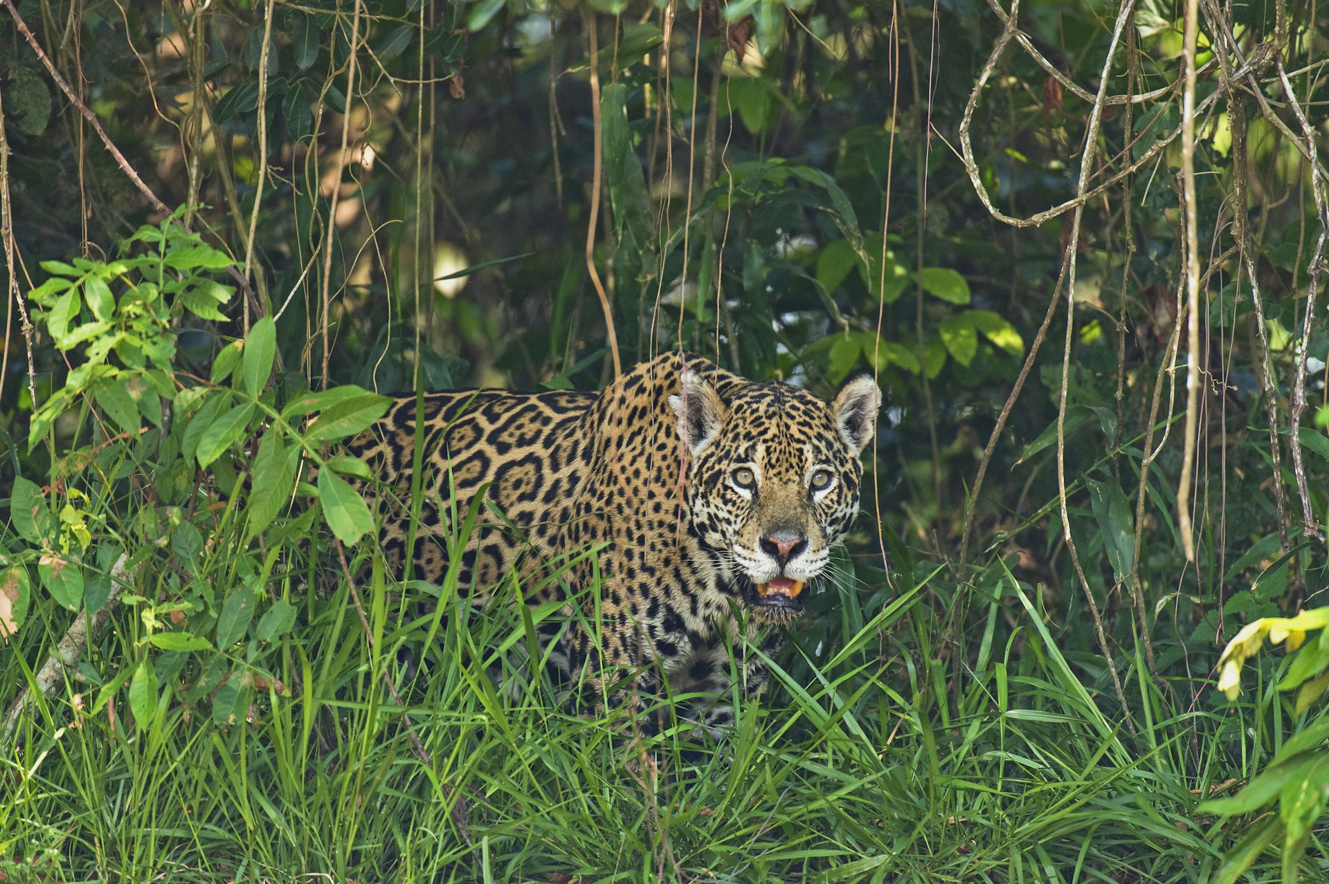
This natural wonderland is a must-visit for wildlife lovers – the forests teem with big creatures such as caimans, capybaras and jaguars and a menagerie of birds. The best way to reach more remote parts of the Panatal is by plane or boat, but you can get here on four wheels following the road known as the Transpantaneira – route MT-060.
This dirt road cuts into the Pantanal from the north and can be driven in a regular car during the dry season (April to September) when wildlife is also easier to spot. However, a 4x4 is essential during the rainy season when rivers can turn into lakes. Hotels of varying standards line the Transpantaneira, and most can arrange boat rides and nocturnal excursions to seek out wildlife.
When fires ravaged the Pantanal in 2020, a campaign was launched to encourage tourists to visit, promoting responsible tourism as a viable economic alternative to cattle ranching to help protect the region's unique biodiversity. The Instituto Homem Pantaneiro is a local NGO that, among other things, promotes ecotourism experiences, investing its income in local conservation projects.
Espírito Santo Mountains
Best road trip for eating and drinking
Start – Vitória; Finish – Alto do Caparaó; Distance – 151 miles/243km
The coastal state of Espírito Santo is sandwiched between Rio de Janeiro and Bahia, and its green mountains offer some of Brazil's best hikes. Less than an hour’s drive from the state capital, Vitoria, the BR-262 highway climbs slowly up into the Serra Capixaba where an agritourism scene has flourished in recent years.
Organic farms, delis, restaurants, cafes and guesthouses are all mapped out on a gentle route that connects Domingos Martins and Venda Nova do Imigrante.
In the mid-19th century, immigrants began to arrive in this area from Germany, Italy and Pomerania (a historical region on the Baltic Sea), and they lived in relative isolation until the BR-262 was constructed in the 1960s.
Many of their traditions are still alive, particularly in their kitchens. In Venda Nova do Imigrante, highlights include socol (a pork sausage of Italian origin) and polenta – the town even hosts an annual polenta festival serving up a giant pot of polenta weighing in at more than one ton.
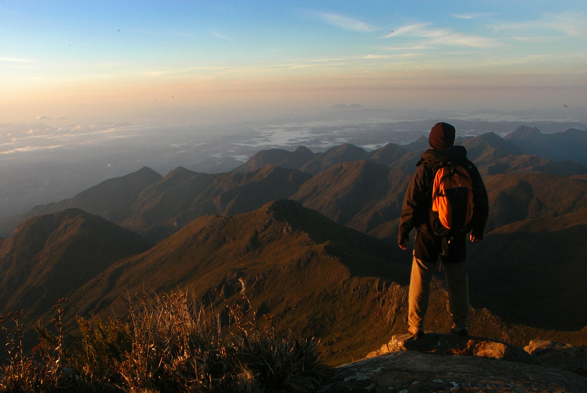
The Rota do Lagarto, a bucolic 8km (5-mile) detour off the BR-262, goes past the entrance to the Pedra Azul state park where hikers can climb to the top of the “blue” granite rock that gave the park its name. For equally stunning vistas and a more challenging hike, it’s a further 62 miles to 2892m (9488ft) Pico da Bandeira, the third highest mountain in Brazil.
Rio do Rastro
Best road trip for panoramic views
Lauro Muller–Bom Jardim da Serra; 34km (21 miles)
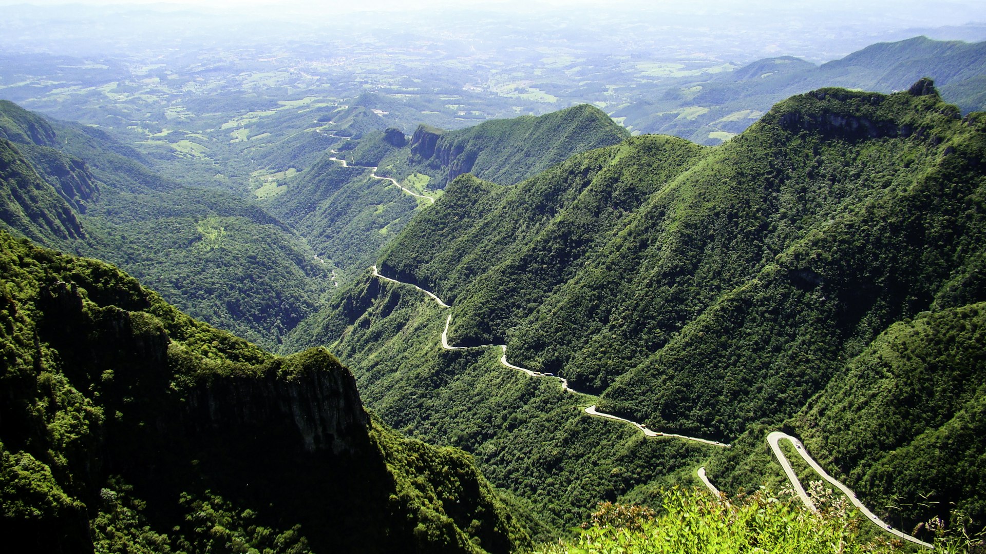
High up in the Serra Catarinense, where the tops of the peaks are sprinkled with snow in winter, the Rio do Rastro road winds its way along a sheer ridge in a series of sharp chicanes. This short stretch of road, which precariously hugs a steep mountainside, is possibly the most breathtaking drive in Brazil.
Spectacular views of the valleys below open up beside the route, and panoramic lookout points along the way allow drivers to stop and snap away. Start or end in either Lauro Muller or Bom Jardim da Serra – the two small towns that bookend the Rio do Rastro road, officially known as the SC-390 – finishing about 100km (62 miles) east on the coast.
The road’s highest point, the 1460m (4790ft) Mirante Serra do Rio do Rastro, is a good spot to park and have lunch. On a clear day, visitors can see as far as the Atlantic Ocean; avoid the morning fog by visiting between 11am and 3pm.
From here, it’s a short 2.9km (1.8-mile) detour to visit the Cânion da Ronda – a canyon with a 360-degree view, a wind farm and a rewarding short hiking trail. While in the area, the Barrinha waterfall is worth a stop.