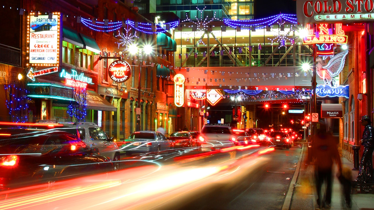
The car is king in the Motor City, as you might expect in the USA’s auto-making hub. Back in the day, everyone in Detroit worked in the motor industry and cars were famously cheap, so the city never developed an integrated public transportation system.
Modern Detroit is quite spread out, which means you'll appreciate having your own wheels if you want to buzz between neighborhoods. On the other hand, new transport options are making the city easier to navigate. Detroit recently rolled out a handy streetcar route, a convenient bike share program and enhanced bus services.
Here’s the lowdown on driving, public transport options, and the other top ways to get around the city.

Tips for driving in Detroit
Driving is how most people explore the Motor City and it's still the quickest, easiest way to cover Detroit’s vast expanse. Traffic flows fairly smoothly, especially if you avoid I-94 and I-75, the major highways slicing through town. Five major avenues fan out from downtown to the suburbs: Gratiot, Michigan, Grand River, Jefferson and Woodward. If you ever get lost, hop on one of these thoroughfares and it’ll bring you downtown.
The rush hours every morning (7am to 9am) and evening (4pm to 6pm) are busy but the roads rarely grind to a halt. Parking is widely available and cheap ($2 to $5 per hour) compared to other big cities, both on the street and in parking lots.
If you plan to hire a car on arrival, the usual international hire firms are represented at Detroit Metro Airport.
Tip for parking: The ParkWhiz app will help you locate spaces in garages and lots, while the ParkDetroit app offers an easy way to pay for parking meters on the street.
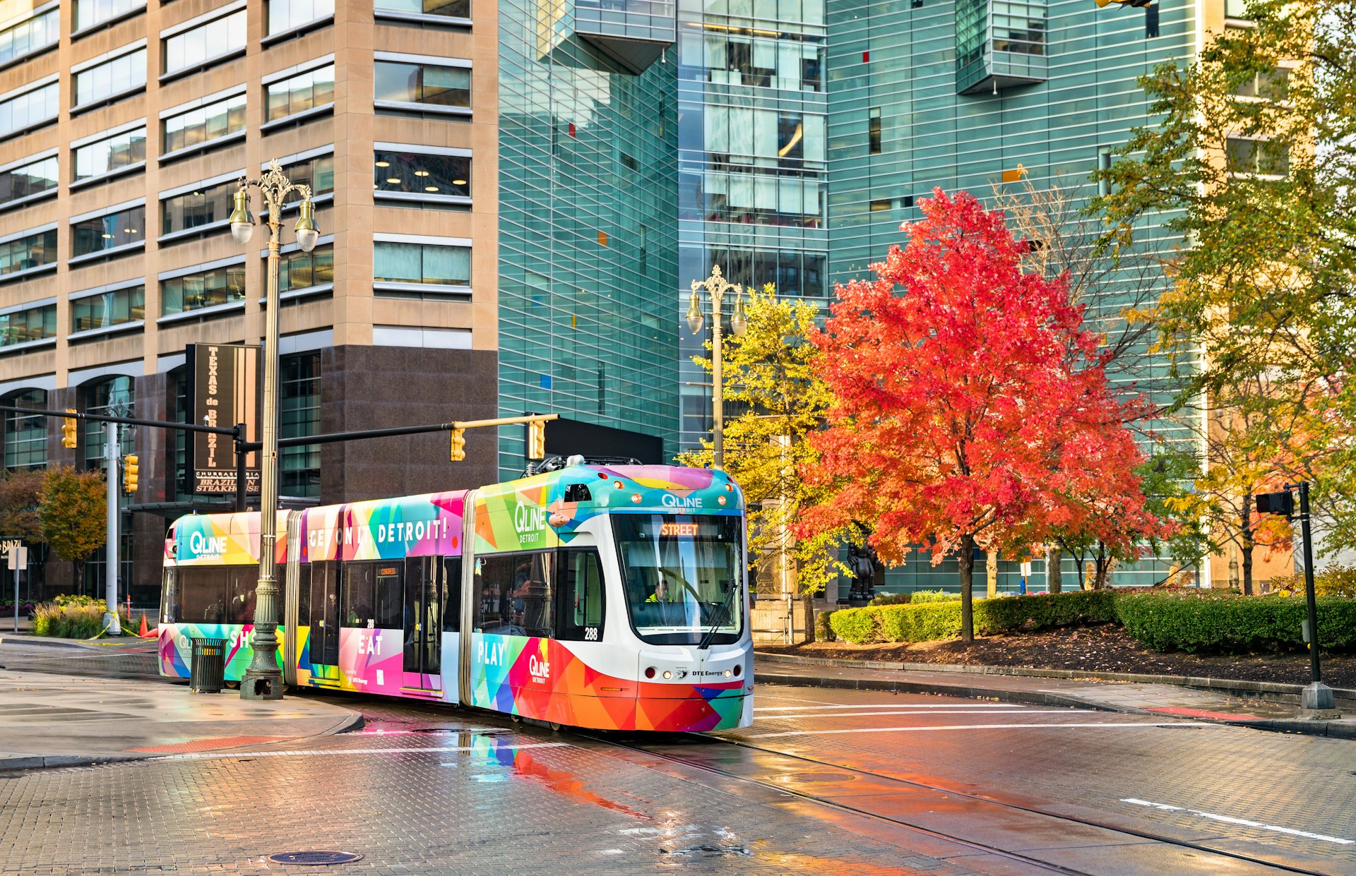
Ride the QLine streetcar to Detroit’s top sights
Non-drivers, fear not – you can now zip around downtown Detroit easily without a car. Launched in 2017, the QLine streetcar skims along Woodward Ave through downtown, Midtown, New City and the North End neighborhoods, providing access to many of the main sights.
Top draws including Campus Martius Park, the theater district, Comerica Park, the Detroit Institute of Arts and the Fisher Building all lie along the 3.3 mile-long, 12-station route. You may have to walk a bit from the stops, but the QLine is a great way to hit the highlights if you don’t have a car.
The clean, wifi-enabled streetcars run every 15 minutes from 8am to 8pm (till 10pm Friday and Saturday) and rides are free until April 2022. After that fares will cost $2 for a four-hour pass, or $5 for a 24-hour pass, available via the Dart app or at station kiosks.
Tip for riding the QLine: To know when the next QLine tram is coming to your location, or the next bus or People Mover train, use the Transit app. It also has route maps and schedules, plus listings for bike share locations.
Hop on a bus to travel to Detroit’s suburbs (and the airport)
Detroit Department of Transportation (DDOT) buses operate within the central part of the city, while buses run by SMART (Suburban Mobility Authority for Regional Transportation) go between the city and suburbs. The central station for both is downtown’s Rosa Parks Transit Center, named for the legendary civil rights activist, who moved to Detriot from Montgomery, Alabama, and passed away here in 2005.
While locals often moan that Detroit’s buses are slow and infrequent, there are exceptions. You can get around efficiently on the city's FAST buses – buses on the SMART network that travel along three main avenues: Gratiot, Woodward and Michigan. These services run more frequently than other buses (usually every 15 to 30 minutes) and have fewer stops. The most useful of the lot is FAST Michigan, which goes to Dearborn and onward to Detroit Metro Airport (a one-hour ride, with stops at both terminals).
All buses charge the same fare: a flat rate of $2 for a four-hour pass or $5 for a 24-hour pass, payable via the Dart app or onboard using cash ($1, $5, and $10 bills only). Routes and schedules are available via the Transit app.

Public Transport Passes
On Detroit's buses and streetcars, the Dart Pass operates like a public transport pass. It's valid on all buses and the QLine streetcar, and you can purchase a physical pass from transport stations, or pay via their app. It costs $2 for a four-hour pass, and $5 for a 24-hour pass that allows unlimited rides during that time.
Pedal around Detroit on a MoGo bicycle
MoGo is Detroit's bike share program, with 620 bikes at 75 stations scattered around downtown, Midtown and nearby suburbs. A pay-as-you-go pass costs $1 to unlock the bike and 25 cents for each minute you ride. A prepaid pass costs $18, covering two hours of ride time that you can use all at once or break up into multiple trips. Download the Transit app to find available bicycles and to purchase passes.
The city is great fun to explore on two wheels. It’s flat and there isn't too much traffic outside of rush hours. Sweet leisure rides include the Detroit Riverwalk, Dequindre Cut Greenway and Belle Isle trail, which take you around some of the most appealing parts of town avoiding the roads.
Enjoy the view from the People Mover light rail
As far as mass transit systems go, Detroit's People Mover won't get you very far; trains complete a 3-mile loop on elevated tracks around downtown. As a tourist attraction, however, this is an awesome ride providing grand views of the city and riverfront.
Why do people love the People Mover? It’s so old school. It doesn’t really go anywhere, just snakes one way around its skinny track, floating 45 feet above street level. It swings close enough to downtown’s skyscrapers that you can almost touch them and lurches out along the Detroit River, all the while making a weird, whirring noise punctuated by a robot voice announcing the stops. It’s the best 75 cents you’ll spend in Detroit! Not to mention all of the stations sport cool public art installations.
There are 13 stations, including useful stops at the Renaissance Center and Greektown. It takes 16 minutes to make the journey all the way around the center, and the trip costs a mere 75 cents. Pay at the station farebox or turnstile.
At the time of writing, the People Mover was closed due to flooding and other issues, with services expected to resume in 2022. Make sure trains are running before you head out

Ridesharing and taxis in Detroit
Lyft and Uber are easy to hail in downtown, Midtown, Corktown and the other main neighborhoods where visitors frequently go. Conventional taxis often queue outside downtown hotels and the Huntington Place convention center. Note that some firms may be reluctant to take longer journeys across town; Checker Cab is one reliable operator.
Accessible transportation in Detroit
Detroit’s buses, QLine streetcar and People Mover train are all ADA-accessible, with facets including wheelchair lifts or ramps, and stops that are announced using both audio and digital displays. Service animals are allowed on all transport. MoGo offers recumbent tricycles, tandem bicycles and other cycling options through its adaptive bike share program.
Detroit's Office of Disability Affairs has further information. For general online resources for accessible travel, visit Lonely Planet's Accessible Travel Resources.
You may also like:
Best day trips from Detroit: 5 quick getaways for beer, birdlife and Bavarian architecture
The best free things to do in Detroit from art deco architecture to edgy street art
Experience the Great Lakes on one epic road trip