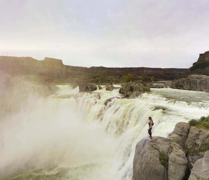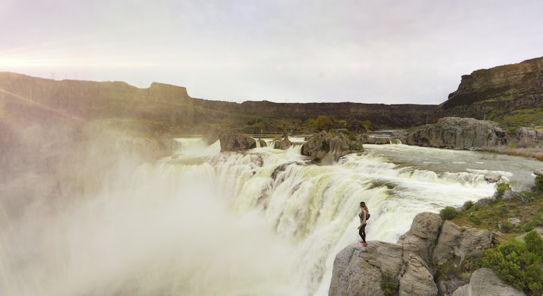
Much more than a resort town with a supermodel-tall 11,000-foot mountain, Mammoth Lakes is the crème de la crème of California summer playgrounds and the gateway to the Eastern Sierra’s most scenic and wild destinations.
Blessed with sunshine almost three hundred days per year, it’s a place where you can spend the morning hiking to a remote alpine lake, bike miles of high altitude trails after lunch and then kick back over homegrown microbrews in the crisp evening. To embrace its myriad outdoor adventures, lace up your trail shoes, top off your water bottle and throw on some sunscreen.

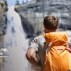
Reds Meadow and Devils Postpile
When the snow turns to mush at the base of Mammoth Mountain ski resort, road access resumes to Reds Meadow, a forested valley of campgrounds and trailheads dotted around the sinuous San Joaquin River. Visitors walk in to gawk at the wobbly basalt columns of Devils Postpile (nps.gov/depo), an ancient volcanic formation that looks like a 60-foot-high palisade of clumped spaghetti. Hike to the top to survey its hexagonal-patterned surface, and then continue south along the trail to cool off by the spray of Rainbow Falls, which wows with a hundred-foot leap and an eponymous sheen.

Make sure to detour at the Reds Meadow road entrance and stroll to the Minaret Vista lookout. At an elevation of 9300 feet, panoramic high peaks surround and dazzle, with jagged granite spires bathed in alpenglow at sunrise and sunset. A helpful chart plots out the dramatic summits – the Minarets of the Ritter Range – visible on the horizon.
Tantalizing trails
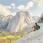
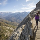
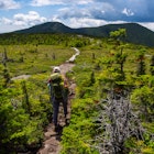
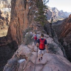
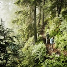
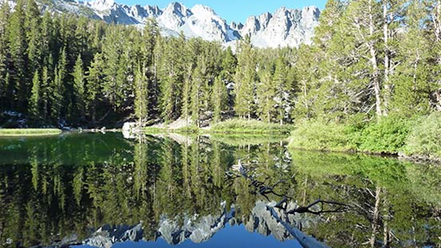
Mammoth Lakes backs directly onto the Sierra Nevada range, and scores of trailheads lead to steely mountains and canyons flecked with pristine lakes. From Reds Meadow, ambitious backpackers can jump onto the long-distance trails of the John Muir Trail, heading north to Yosemite National Park and south to the crowning pinnacle of Mt Whitney, or the Pacific Crest Trail, which treks from Mexico to Canada and traverses some of the country’s most captivating wilderness areas. Closer destinations here include daytrips to Shadow and Ediza Lakes and backcountry overnights to the islet-jeweled basins of Thousand Island and Garnet Lakes, all lorded over by snow-draped 13,000-foot peaks. South of town, day hikes in the Lakes Basin and Rock Creek areas romp through mountain-studded landscapes coveted by anglers and bursting with a palette of brilliant wildflowers.

Mountain path. Image by Nicolás Boullosa / CC BY 2.0
If spinning wheels are your preferred means of self-propulsion, Mammoth Lakes maintains a comprehensive network of bike routes and numerous rental shops. The Lakes Basin Path, a five-mile paved path from town to Horseshoe Lake, boasts expansive Sherwin Range views and a number of stop-worthy lakes. To go easy on your lungs and sidestep the 1000-foot ascent to Horseshoe Lake, take the free bicycle shuttle up from the Village complex and turn the journey into an easy downhill coast. For something more challenging, the Mammoth Scenic Loop gains even more elevation on a 16-mile route that cuts north and over to Hwy 395 via a two-lane road buffered by Jeffrey pine forest.
Earthquake Fault
Halfway up the road to Mammoth Mountain, don’t overlook the turnoff for Earthquake Fault, a stark geological cleft that tunnels two stories into the ground. Formed by molten rock escaping to the surface about 600 years ago, the two sides of the fissure, six to ten feet apart, fit together like a rock hound’s fantasy jigsaw puzzle. A path meanders along the rim of the deepest section, where snow and ice lingers at the bottom year-round and early settlers and Native Americans once preserved food. Picnic on tables set under a serene canopy of pines and old-growth red fir trees, and watch chipmunks scurry into the slashed earth.

Hot springs
Local hot springs are a modern-day reminder that volcanic upheavals have forged the region’s topography. Near the airport, bubbles simmer to the surface of the Hot Creek Geological Site, a frigid trout-filled waterway straddling an active geothermal vent. Ramble from an overlook to the creek bank, where clear blue puddles boil and steam hisses beneath the rocks. Once a popular though unsettling swimming hole – bursts of scalding water could surge up without warning – it’s become unstable enough that dips are now off limits. So consider the magma chamber a few miles beneath your feet and appreciate the spectacle from the safety of the sidelines.