Apr 21, 202612 min read
How to get around New York City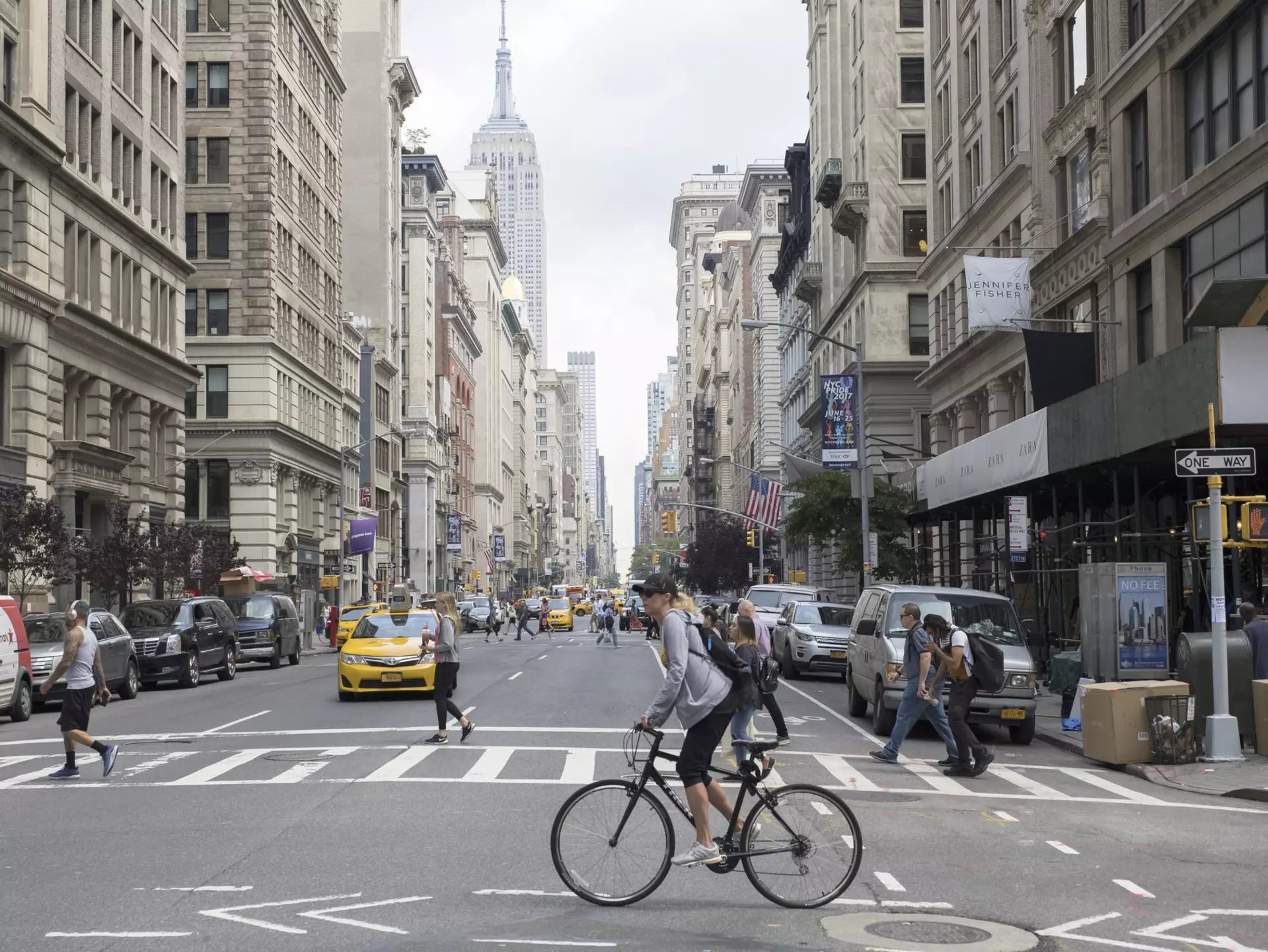
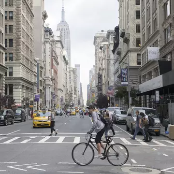
Pedestrians, cabs and cyclists at the intersection of Fifth Ave and 18th St in NYC. Guillaume Gaudet/Lonely Planet

If there's one thing that will impact how you choose to get around in New York City, it’s the weather. Taking the subway in summer or opting to walk in the depths of winter can challenge even the hardiest of travelers.
This city never sleeps, largely because you can get anywhere, anytime, thanks to night owl cabbies and trains that run around the clock. The party keeps going in NYC for as long as you’re willing to join it.
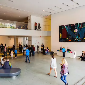
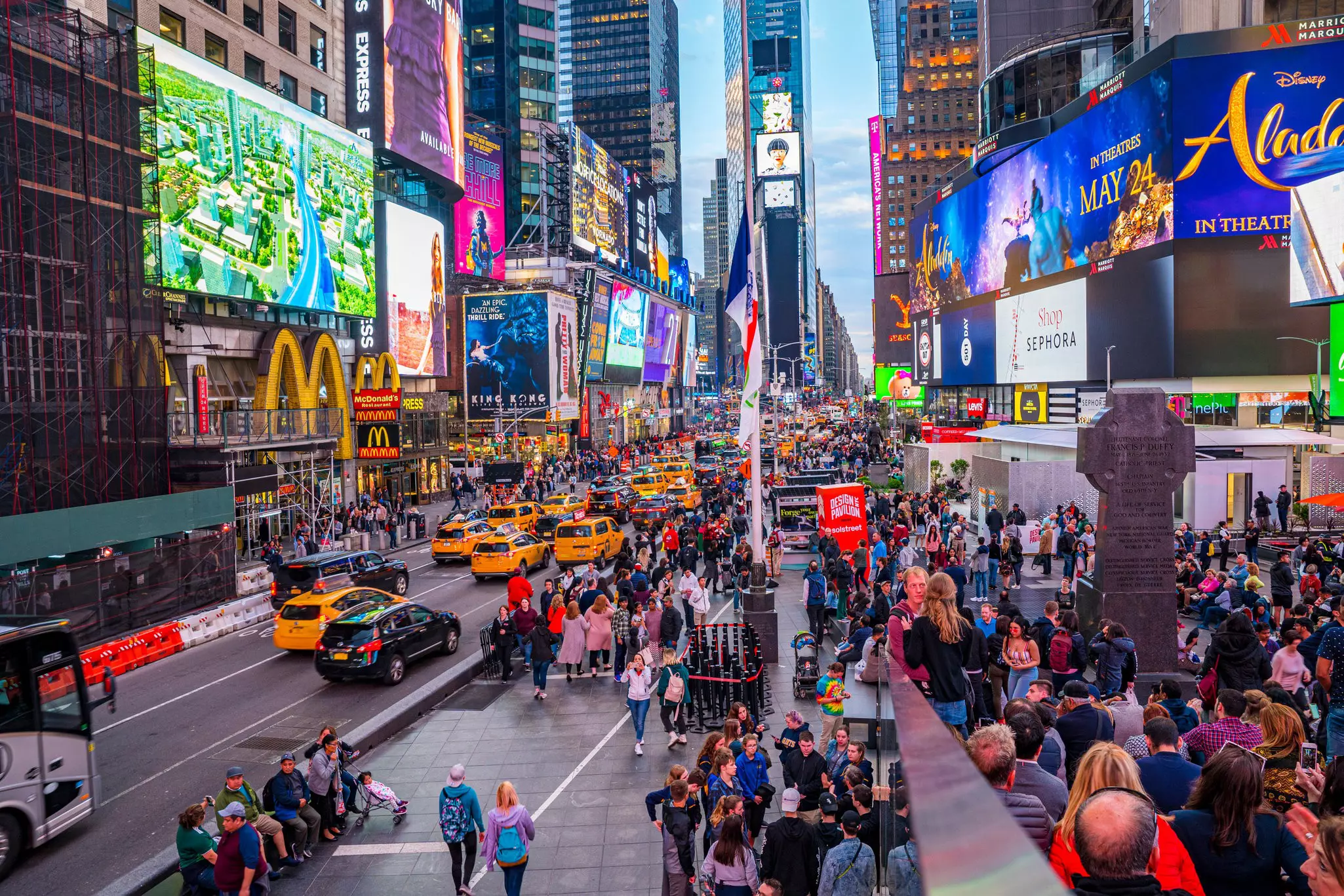
Everyone thinks of yellow cabs and the subway when they think of New York – and the extensive public transit system is indeed a source of pride and frustration for the city’s millions of residents – but there are many more options for getting around.
Buses, ferries and commuter trains complete the public transit system, and getting around on foot can be one of the most rewarding ways to explore. Some adventurous, patient souls even choose to get around by bike or car.
Best of all, public transit is inexpensive; combined with the many free things to do in NYC, this can help offset the cost of accommodation. Here's everything you need to know about getting around New York City.
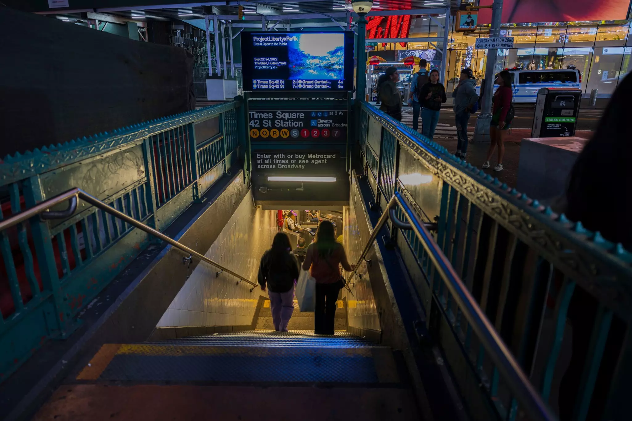
With 25 routes covering more than 665 miles of track, the New York City subway system is a behemoth, welcoming 1.7 billion riders annually. It’s operated by the Metropolitan Transit Authority (MTA) and covers Manhattan, Brooklyn, Queens, the Bronx and Staten Island, though the latter’s trains don’t connect to the other boroughs directly. (You’ll need to reach Staten Island by bus or ferry.)
Unlike other major cities in the US, New York’s subway trains run 24 hours a day, seven days a week. However, with the system’s advanced age – 28 stations date back to 1904, and signals from the 1930s are still in use today – its susceptible to delays and breakdowns. Repairs and maintenance are often scheduled for nights and weekends, so weekend subway travel can be challenging. You’ll find countdown clocks in every station, telling you when the next train is coming.
To keep on top of service changes, the MYmta app is frequently updated with information on each line. It’s a handy tool for trip planning in general, but Google Maps is even better for plotting a route, with integrated service info as well as details on stations, schedules and the onboard experience. The MTA’s X feed is also worth bookmarking for up-to-the-minute info on service disruptions and delays.
Tips for taking the subway: Standing on the subway without holding on to something is a rookie mistake. If you’re not familiar with the way the trains stop and start, it’s a good way to wind up in a stranger’s lap. Do everyone a favor and hold on to a pole – or even better, grab a seat if there’s one available and enjoy the ride. If you’re standing, take your backpack off and hold it in your hand to create more space for those around you.
Before you board, be aware that empty cars on otherwise busy trains may be empty for a reason. It could be a terrible smell or a mess on the floor, but trust us – you don’t want to find out. You’re often better off in a crowded car or even waiting for the next train if you have to.
The MTA is also responsible for the city’s buses, and its fleet includes nearly 6000 vehicles. For the most part, New York’s buses run on a grid, and routes run uptown, downtown and crosstown, with stops on every (or every other) corner. There are local buses with frequent stops as well as express lines, which eliminate local stops. The select bus service (SBS) is even faster but requires prepayment before boarding – unless you pay with a contactless credit or debit card, which you can tap at the bus’s OMNY reader upon boarding.
For a normal bus trip, pay the fare (3 US dollars; US$3) as you board with a contactless credit or debit card, or exact change (coins only). For SBS routes and certain regular routes (like along 14th St), buy your ticket before you board from one of the kiosks near your stop (you can also tap your credit or debit card upon boarding normal buses). You won’t have to show your ticket to the driver, but you do need to keep it for the duration of the trip in case of inspection – don’t lose it, or you could get hit with a hefty fine.
The MYmta app has timetables and service info for buses, and each bus stop has a QR code that’s scannable for arrivals, departures, and status updates.
To travel on any bus or train operated by the MTA costs US$3 per ride, payable via contactless credit or debit payment, or via OMNY, a touchless ticketing system introduced in 2019. The last of MetroCard usage in the city ended in December 2025. (RIP!) Up to three children less than 44 inches tall ride for free when they’re with a paying adult. Infants and children younger than two years old also ride free so long as they're sitting in the lap of a fare-paying adult.
If you’re paying per ride, you get one free transfer within two hours of your first swipe (subway to bus, bus to subway or bus to bus). When transferring use the same card or device for each leg of the trip. If you move from the subway or local bus to an express bus, you'll be charged the difference between the two fares.
For contactless payment, you can either pick up an OMNY card and top up your account online, or tap your contactless credit or debit card or electronic device on an OMNY reader to pass through the turnstile.
The subway gets all the attention, but New York’s ferry system is a rewarding and much-underrated means of transportation. Seeing New York from the water can also be a fun, low-cost feature of a day out with kids.
The Staten Island Ferry runs from the Whitehall Ferry Terminal in lower Manhattan to the St George Ferry Terminal in Staten Island. It’s also a great way to take in waterside views of the Statue of Liberty – and it’s absolutely free.
NYC Ferry connects communities along the city’s waterways, including South Brooklyn, the Rockaways, Western Queens and the Bronx, with seasonal routes between Manhattan and Staten Island, Governors Island, and Coney Island. Tickets can be purchased from vending machines at the landings or via the NYC Ferry app; single-ride tickets for adults cost US$4.50.
NY Waterway operates between Manhattan and New Jersey, making stops in midtown, Battery Park City, and Wall Street before crossing the Hudson River and docking in Jersey City, Hoboken, Weehawken, and Edgewater. Fares vary by route.
Along with the subway, NYC has a useful network of suburban trains – the Long Island Rail Road (LIRR), Metro-North Railroad, NJ Transit and PATH – that bring legions of commuters to Penn Station, Grand Central Station, Secaucus and Hoboken. Amtrak trains from further afield also arrive in and depart from Penn Station.
Fares depend on the line and length of the trip but the trains are a cost-effective way to reach outlying locations, including Newark Liberty International Airport (in New Jersey), Westchester and Fairfield Counties and the beaches of Long Island.
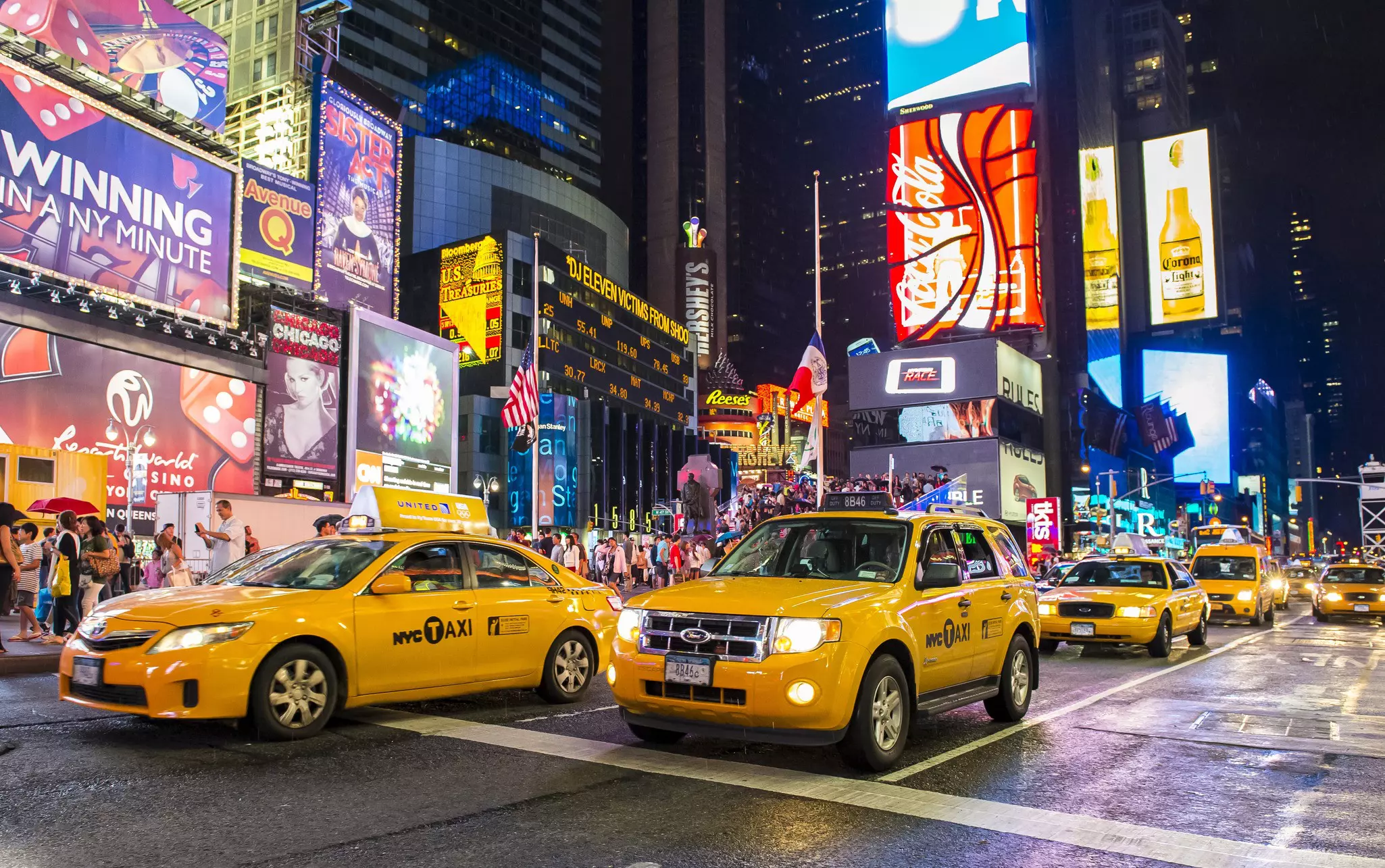
Few things are more iconic than the swarms of yellow cabs flooding New York City’s streets. Cabs licensed by the NYC Taxi & Limousine Commission are metered, with fares starting at US$3, plus US$0.60 per mile if traffic is slow or stopped and $0.70 per 1/5 mile if it’s moving at least 12 miles per hour. There are also various surcharges depending on when and where you’re traveling, not including tolls and tip (customarily 15 to 20 percent).
To hail a cab, look for one with its rooftop lights on and raise your arm to signal for pickup; lights off are a sign that a taxi is occupied or off-duty. An assortment of apps, including Curb, Waave and Myle, let you book rides with TLC-licensed cabs in advance. Be aware that green taxis operate in outer New York boroughs as well as yellow cabs.
It’s technically illegal for drivers to refuse to take you anywhere within the city limits, so push back if they tell you they don’t want to go to the outer boroughs.
Uber and Lyft are both extremely popular in New York; rates often undercut yellow cabs and your ride will usually arrive after only a short wait. Via is another ride-hailing app that operates here, often with cheaper rates than its bigger-name brethren.
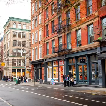
If you’re not in a hurry, traversing the city on foot is one of the best ways to see the sights. Pick a neighborhood and get lost in its side streets, or choose an avenue and follow it from one end of Manhattan to the next.
Just be aware of your surroundings – the sidewalks can be crowded enough that if you’re staring up at the skyline or down at your phone, or if you stop suddenly or change directions unexpectedly, you’re bound to collide with someone. And New Yorkers are not shy; you'll hear about it.
Sidewalk etiquette dictates that you walk on the right with no more than two people across when others are around – any more than that, and you’ll be blocking the flow of foot traffic in either direction (and again, you'll hear about it). Winter months are cold in New York, so bundle up and expect occasional ice and snow, too. Luckily, there are plenty of coffee shops and cafés to duck into for a warm-up.
With the introduction of dedicated cycling lanes and a popular bike-sharing system, New York has become more cycling-friendly over the years. But considering the chaos of vehicular and pedestrian traffic, city biking isn’t necessarily an activity for beginners. Regardless of skill level or experience, a helmet is essential.
The bike-sharing program, Citi Bike, has more than 1300 stations and 20,000 bikes within the city limits and across the river in Jersey City. A single 30-minute ride costs US$4.99, and day passes cost US$25 and cover as many 30-minute rides as you can handle in 24 hours; annual memberships are also available. After buying a pass, check the app to find the closest station; pick a bike, scan the QR code on its handlebars and get pedaling. You can also pay by card at any kiosk.
First things first: take safety seriously. Despite the city’s Vision Zero initiative to decrease traffic fatalities, thousands of cyclists are involved in accidents here each year.
Read up on how to cycle like a pro before you go. There are some 1375 miles of bike routes, but you’ll often find cars idling in dedicated bike lanes; keep an eye out for taxis pulling over to discharge their passengers, and anyone opening a car door – never assume they’ve checked for oncoming bikes.
If you don’t fancy dealing with vehicle and pedestrian traffic, saddle up and head for one of the city’s green spaces. Central Park and Prospect Park have paved loops that are popular with cyclists. There are also greenways along the East, Hudson and Harlem Rivers.
Our advice about driving in New York is quite simple: don't do it. Between the traffic snarls and the impossible-to-find parking spots, public transportation, taxis and ride-hailing apps are the way to get around here.
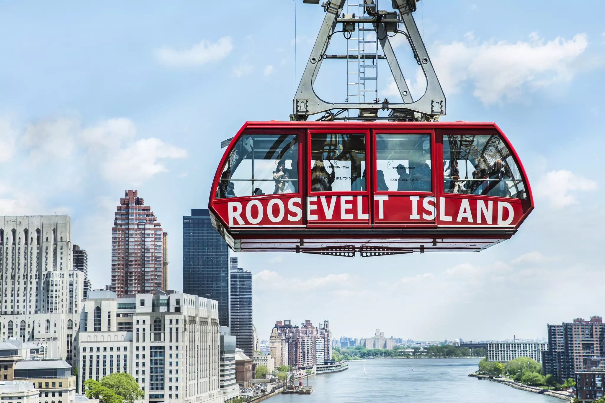
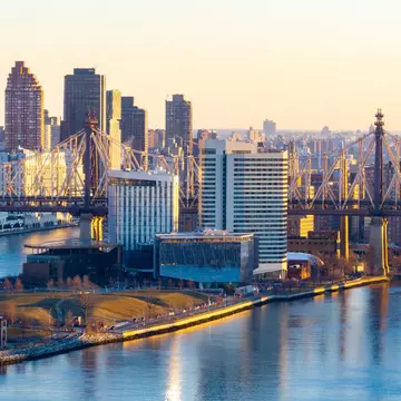
A tiny spit of land measuring just 1.75 miles long, the East River’s Roosevelt Island has been home to hospitals, an asylum and a prison. But these days there are high-rises interspersed with historic architecture, green spaces and unbeatable skyline views.
Get there by subway, bus or ferry, but taking the aerial tram is half the fun. It departs every seven to 15 minutes from 59th St and Second Ave in Manhattan and costs just US$3.
New York’s subway system can be difficult to navigate for travelers with disabilities, even given the MTA’s push to become more accessible in recent years. In 2022, the MTA pledged in its Capital Plan to invest US$5.2 billion into reaching a goal of making 95 percent of MTA stations accessible by 2055.
Braille and raised-lettering signage do appear at most street-level entrances, while service changes and PSAs are announced visually and over a loudspeaker. There is an accessible boarding area near the middle of the platform – that’s where the conductor’s car usually stops, and where the gap between the platform and the train is the narrowest. The MYmta app keeps track of elevator and escalator outages systemwide.
Bus transit can be a better option. The driver can lower the bus or let down a ramp or lift for wheelchair users, then secure the chair or scooter in place; once on board, priority seating is available for seniors and passengers with disabilities. Service animals are allowed systemwide, as long as they’re kept on a leash.
Wheelchair-accessible taxis are also available, either by dispatch, car service, ride-share app, or flagging them down in person. Ride-sharing apps like Curb and Myle are licensed by TLC and give passengers the option of requesting wheelchair-accessible vehicles.